File:Victoria airport canvec.jpg
Jump to navigation
Jump to search


Size of this preview: 800 × 400 pixels. Other resolutions: 320 × 160 pixels | 879 × 439 pixels.
Original file (879 × 439 pixels, file size: 81 KB, MIME type: image/jpeg)
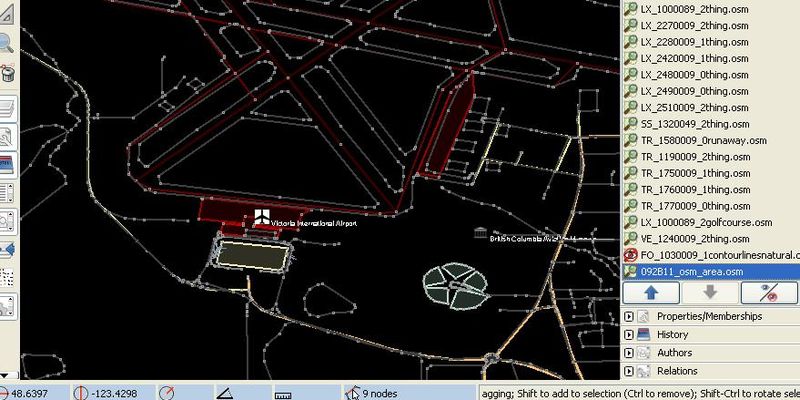
CanVec data view of Victoria,BC airport area, will all the features.
![]()
This file is a JOSM screenshot, without imagery in a background.
![]()
"JOSM" (Java OpenStreetMap Editor – josm.openstreetmap.de) is free software released under the terms of the GNU General Public License as published by the Free Software Foundation; either version 2 of the license, or any later version.
It may include old OpenStreetMap data (before September 12, 2012), in such case CC-BY-SA-2.0 also applies:
![]()
Contains map data © OpenStreetMap contributors, made available under the terms of the Creative Commons Attribution-ShareAlike 2.0 (CC-BY-SA-2.0).
File history
Click on a date/time to view the file as it appeared at that time.
| Date/Time | Thumbnail | Dimensions | User | Comment | |
|---|---|---|---|---|---|
| current | 09:41, 25 February 2009 | | 879 × 439 (81 KB) | Acrosscanadatrails (talk | contribs) | CanVec data view of Victoria,BC airport area, will all the features. |
You cannot overwrite this file.
File usage
There are no pages that use this file.