File:Vysocany concrete rail ties former Northwestern railway.jpg
Jump to navigation
Jump to search


Size of this preview: 450 × 600 pixels. Other resolutions: 180 × 240 pixels | 360 × 480 pixels | 576 × 768 pixels | 768 × 1,024 pixels | 2,112 × 2,816 pixels.
Original file (2,112 × 2,816 pixels, file size: 2.51 MB, MIME type: image/jpeg)
This file and its description are from Wikimedia Commons.
Summary
| Description |
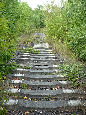
English: Concrete rail ties, Vysočany, Prague (former line to Northwestern Railway Station, also known as Prague-Těšnov) |
| Date | |
| Source | Own work |
| Author | JanSuchy |
| Camera location | | View this and other nearby images on: OpenStreetMap |
|---|
Licensing
| I, the copyright holder of this work, release this work into the public domain. This applies worldwide. In some countries this may not be legally possible; if so: I grant anyone the right to use this work for any purpose, without any conditions, unless such conditions are required by law. |
File history
Click on a date/time to view the file as it appeared at that time.
| Date/Time | Thumbnail | Dimensions | User | Comment | |
|---|---|---|---|---|---|
| current | 16:57, 22 September 2009 | | 2,112 × 2,816 (2.51 MB) | wikimediacommons>JanSuchy | {{Information |Description={{en|1=Concrete rail ties, Vysočany, Prague (former line to Northwestern Railway Station, also known as Prague-Těšnov)}} |Source=Own work by uploader |Author=JanSuchy |Date=2009-08-23 |Permission= |other_ver |
File usage
The following 77 pages use this file:
- Ar:Map Features
- Ast:Map Features
- Az:Map Features
- Bg:Map Features
- Cs:Key:railway
- Cs:Map Features
- Cs:Tag:railway=abandoned
- Da:Map Features
- Demolished Railway
- El:Map Features
- Eo:Map Features
- Fa:Map Features
- Fi:Kartan ominaisuudet
- Gcf:Tag:railway=abandoned
- He:Map Features
- Hu:Key:railway
- Hu:Map Features
- Key:railway
- Lt:Map Features
- Lv:Map Features
- Map features
- Ne:Map Features
- Pl:Key:railway
- Pl:Tag:railway=abandoned
- Pt:Key:railway
- Pt:Map Features2
- Pt:Tag:railway=abandoned
- Ro-md:Map Features
- Sr:Map Features
- Sv:Map Features
- Tag:railway=abandoned
- Tr:Map Features
- Uk:Key:railway
- Uk:Tag:railway=abandoned
- Uk:Об'єкти мапи
- Zh-hans:Key:railway
- Zh-hans:Map Features
- User:Chillly/Simple Map Features
- User:H4ck3rm1k3/OSMKeys
- Wiki:Files used by data items/5
- Template:Ar:Map Features:railway
- Template:Az:Map Features:railway
- Template:Cs:Map Features:railway
- Template:DE:Map Features:railway
- Template:Da:Map Features:railway
- Template:Et:Map Features:railway
- Template:FR:Map Features:railway
- Template:Fi:Map Features:railway
- Template:Generic:ES:Map Features:railway
- Template:Hu:Map Features:railway
- Template:IT:Map Features:railway
- Template:JA:Map Features:railway
- Template:Map Features:railway
- Template:NL:Map Features:railway
- Template:Pl:Map Features:railway
- Template:Pt:Map Features:railway
- Template:RU:Map Features:railway
- Template:Uk:Map Features:railway
- Template:Zh-hans:Map Features:railway
- Template:Zh-hant:Map Features:railway
- Template:Zh-tw:Map Features:railway
- DE:Key:railway
- DE:Map Features
- DE:Tag:railway=abandoned
- FR:Key:railway
- FR:Tag:railway=abandoned
- FR:Éléments cartographiques
- ES:Tag:railway=abandoned
- IT:Key:railway
- IT:Map Features
- NL:Kaartelementen
- RU:Key:railway
- RU:Tag:railway=abandoned
- RU:Объекты карты
- JA:Key:railway
- JA:Map Features
- JA:Tag:railway=abandoned