File:WAfricaRoadsPaths-good-mapped-iD.png
Jump to navigation
Jump to search
Size of this preview: 800 × 435 pixels. Other resolutions: 320 × 174 pixels | 640 × 348 pixels | 1,024 × 556 pixels | 1,515 × 823 pixels.
Original file (1,515 × 823 pixels, file size: 2.99 MB, MIME type: image/png)
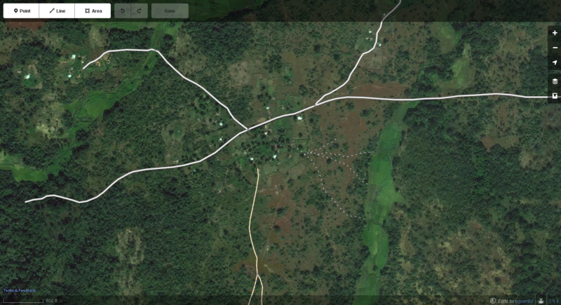
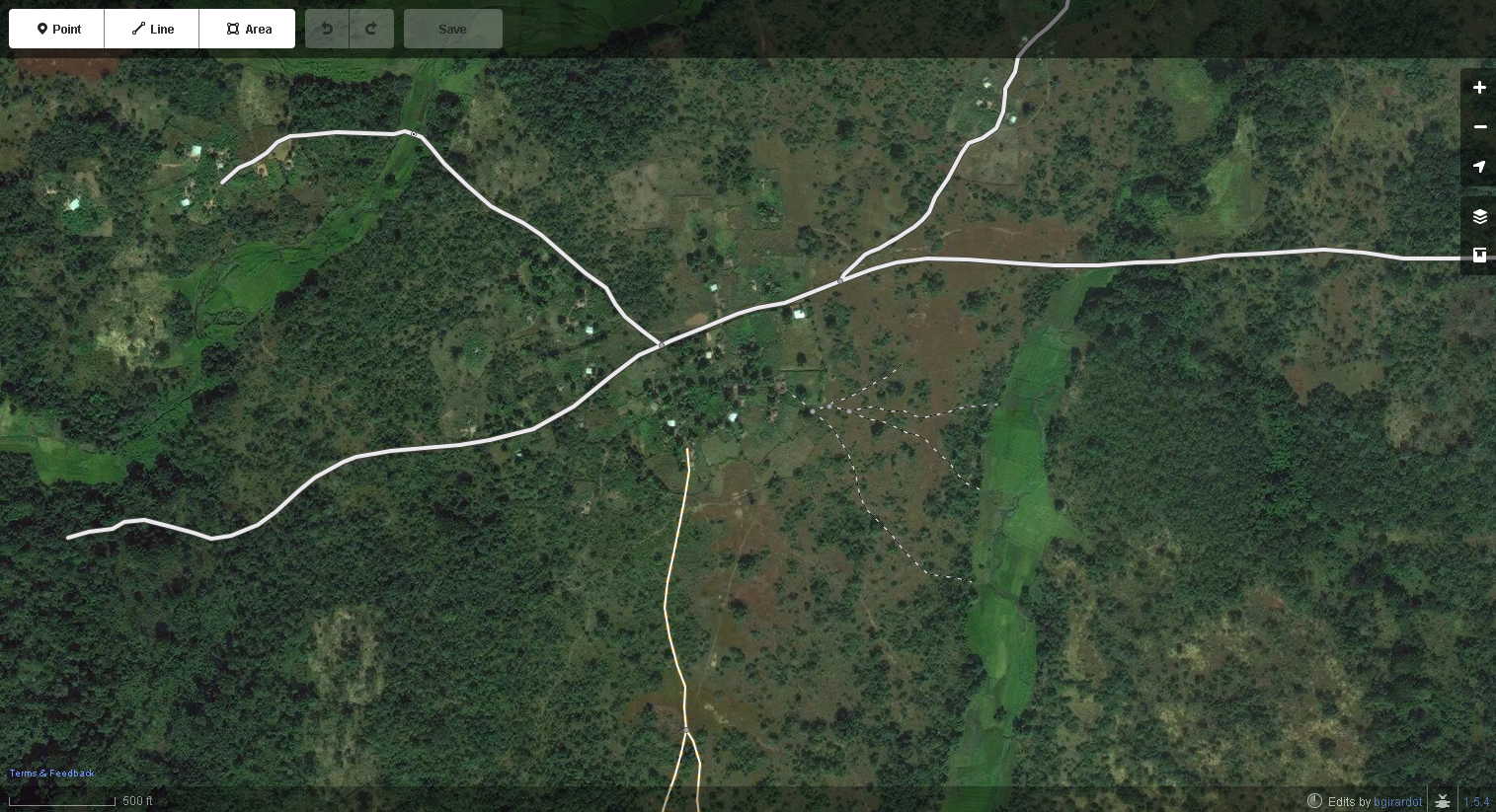
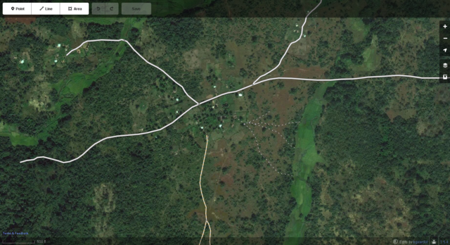
Roads, tracks and paths in West Africa well mapped displayed in iD web browser OSM editor.
![]()
This image is composed partially or entirely of imagery from Mapbox.
The Mapbox imagery is not open licensed, but is made available to the OpenStreetMap project for deriving open licensed map data (see Mapbox page for details). This image is used for illustrative purposes on the OpenStreetMap wiki, to help document ways of using and interpreting the imagery in the OpenStreetMap mapping process and is used here with Mapbox's express permission for that purpose.
The Mapbox imagery is not open licensed, but is made available to the OpenStreetMap project for deriving open licensed map data (see Mapbox page for details). This image is used for illustrative purposes on the OpenStreetMap wiki, to help document ways of using and interpreting the imagery in the OpenStreetMap mapping process and is used here with Mapbox's express permission for that purpose.
File history
Click on a date/time to view the file as it appeared at that time.
| Date/Time | Thumbnail | Dimensions | User | Comment | |
|---|---|---|---|---|---|
| current | 16:43, 18 September 2014 | | 1,515 × 823 (2.99 MB) | Bgirardot (talk | contribs) | Paths marked correctly |
| 14:56, 18 September 2014 | 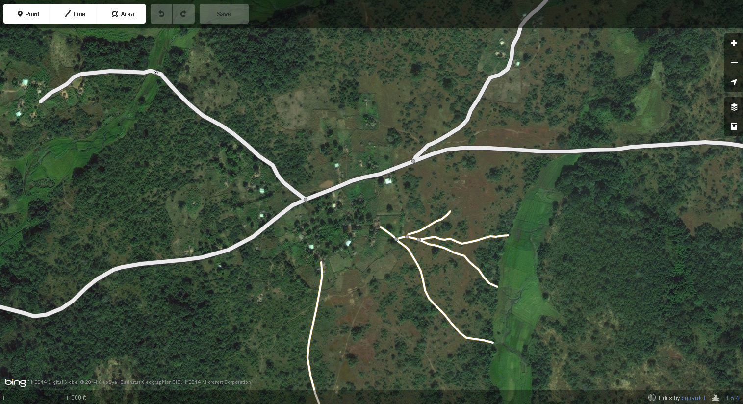 | 1,515 × 824 (2.71 MB) | Bgirardot (talk | contribs) | Roads, tracks and paths in West Africa well mapped displayed in iD web browser OSM editor. {{Mapbox image credit}} |
You cannot overwrite this file.
File usage
The following page uses this file: