File:Western.Pacsco.FL.CDPs.CensusTracts.2010.png
Jump to navigation
Jump to search

Size of this preview: 800 × 517 pixels. Other resolutions: 320 × 207 pixels | 640 × 414 pixels | 1,024 × 662 pixels | 1,280 × 828 pixels | 1,958 × 1,266 pixels.
Original file (1,958 × 1,266 pixels, file size: 2.51 MB, MIME type: image/png)
This file and its description are from Wikimedia Commons.
Summary
| Description |
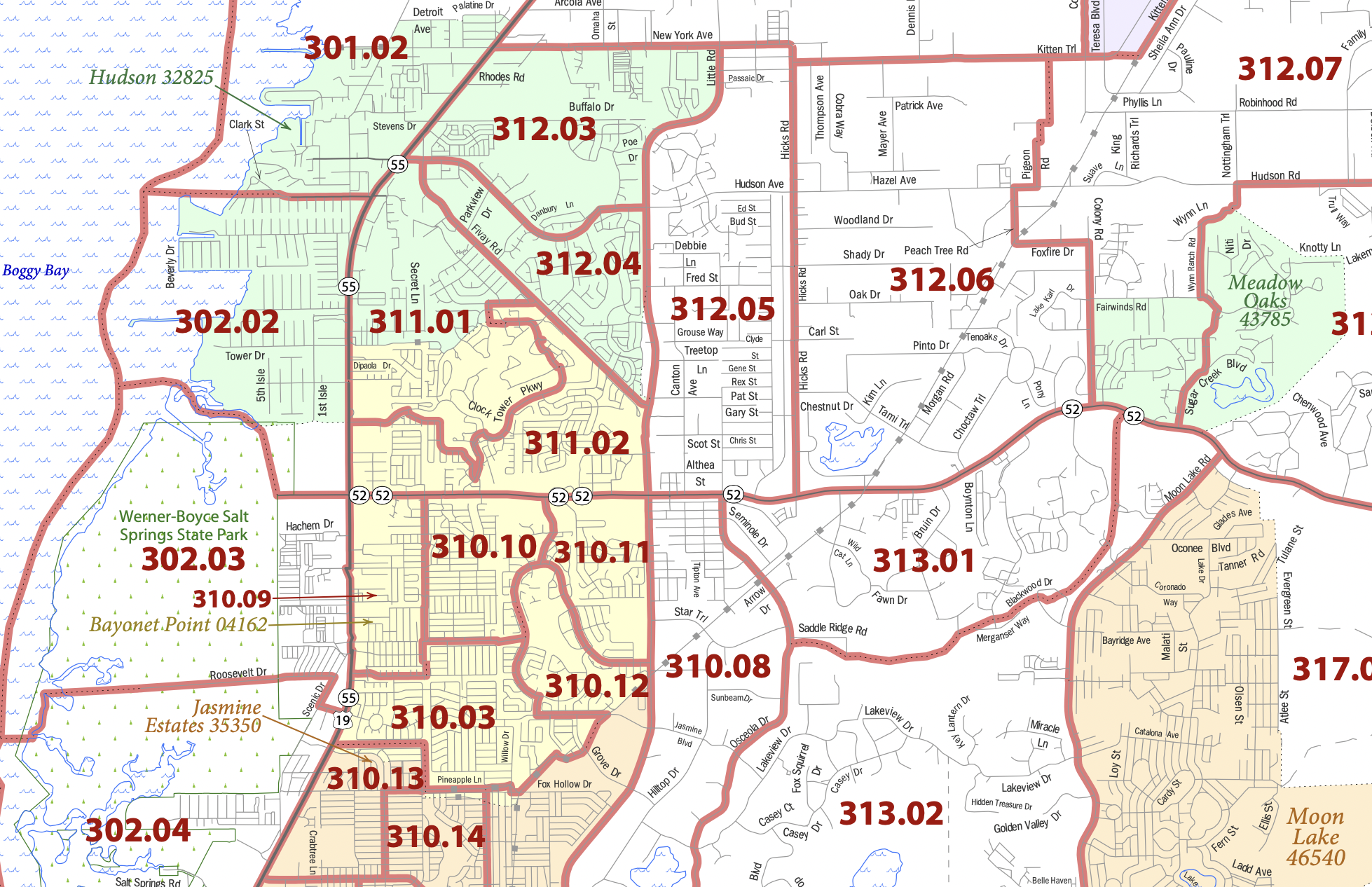
English: Western.Pasco County Florida map identifying census-designated places and census tracts (2010) |
| Date | |
| Source | https://www2.census.gov/geo/maps/dc10map/tract/st12_fl/c12101_pasco/DC10CT_C12101_001.pdf |
| Author | US Department of Commerce |
Licensing
This image or file is a work of a United States Census Bureau employee, taken or made as part of that person's official duties. As a work of the U.S. federal government, the image is in the public domain.
|
 |
File history
Click on a date/time to view the file as it appeared at that time.
| Date/Time | Thumbnail | Dimensions | User | Comment | |
|---|---|---|---|---|---|
| current | 08:33, 13 February 2022 | | 1,958 × 1,266 (2.51 MB) | wikimediacommons>Djflem | Uploaded a work by US Department of Commerce from https://www2.census.gov/geo/maps/dc10map/tract/st12_fl/c12101_pasco/DC10CT_C12101_001.pdf with UploadWizard |
File usage
The following 5 pages use this file: