File:Wootton.png
Jump to navigation
Jump to search


Size of this preview: 729 × 600 pixels. Other resolutions: 292 × 240 pixels | 584 × 480 pixels | 934 × 768 pixels | 1,256 × 1,033 pixels.
Original file (1,256 × 1,033 pixels, file size: 91 KB, MIME type: image/png)
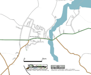
Wootton, Isle of Wight, UK. As at 29 July 2006.
![]()
Contains map data © OpenStreetMap contributors, made available under the terms of the Creative Commons Attribution-ShareAlike 2.0 (CC-BY-SA-2.0).

|
™ OpenStreetMap Foundation This file is (or includes) one of the official logos or designs used by the OpenStreetMap Foundation or by one of its projects. Use of the OpenStreetMap Foundation logos, trademarks and servicemarks may require permission by OpenStreetMap Foundation. If you have questions about your use of the marks, please send your questions to the Licence Working Group of OpenStreetMap Foundation. For more information see the Trademark Policy. |
File history
Click on a date/time to view the file as it appeared at that time.
| Date/Time | Thumbnail | Dimensions | User | Comment | |
|---|---|---|---|---|---|
| current | 14:02, 21 August 2006 | | 1,256 × 1,033 (91 KB) | Dmgroom (talk | contribs) | Wootton Bridge, Isle of Wight, UK. As at 21 August 2006. |
| 23:50, 29 July 2006 |  | 1,367 × 983 (46 KB) | Dmgroom (talk | contribs) | Wootton, Isle of Wight, UK. As at 29 July 2006. |
You cannot overwrite this file.
File usage
The following page uses this file: