File:Xy tile.JPG
Jump to navigation
Jump to search

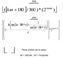
Size of this preview: 639 × 599 pixels. Other resolutions: 256 × 240 pixels | 512 × 480 pixels | 792 × 743 pixels.
Original file (792 × 743 pixels, file size: 43 KB, MIME type: image/jpeg)
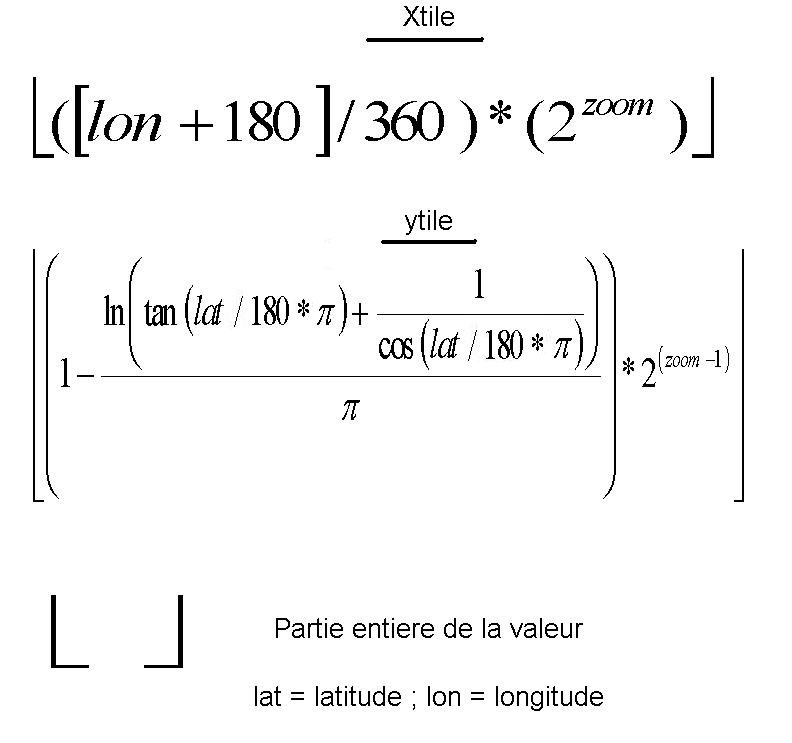
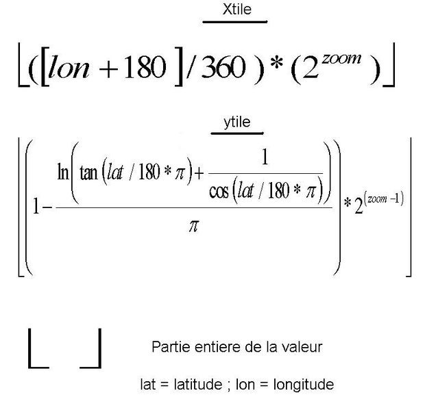
formule mathématique de calcul des tiles (tuiles) d'apres le zoom, latitude et longitude
![]()
This image or logo only consists of typefaces, individual words, slogans, or simple geometric shapes. These are not eligible for copyright alone because they are not original enough, and thus the image is considered to be in the public domain.
See Public domain or Restricted materials on Wikipedia for more information.
Please note: The public domain status of this work is only in regards to its copyright status. There may be other intellectual property restrictions protecting this image, such as trademarks or design patents if it is a logo.
See
Please note: The public domain status of this work is only in regards to its copyright status. There may be other intellectual property restrictions protecting this image, such as trademarks or design patents if it is a logo.
File history
Click on a date/time to view the file as it appeared at that time.
| Date/Time | Thumbnail | Dimensions | User | Comment | |
|---|---|---|---|---|---|
| current | 12:53, 8 December 2010 | | 792 × 743 (43 KB) | Didier2020 (talk | contribs) | erreur de conversion degré en radian. merci a chilobo . |
| 20:55, 27 August 2010 | 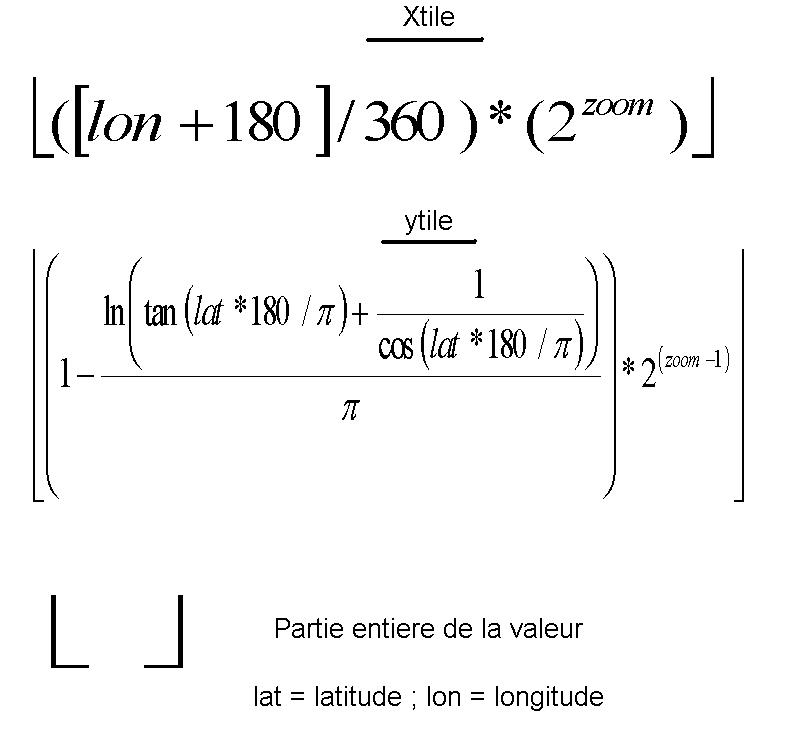 | 792 × 743 (44 KB) | Didier2020 (talk | contribs) | formule mathématique de calcul des tiles (tuiles) d'apres le zoom, latitude et longitude |
You cannot overwrite this file.
File usage
The following page uses this file: