File:Zaragoza-March2010.png
Jump to navigation
Jump to search


Size of this preview: 600 × 600 pixels. Other resolutions: 240 × 240 pixels | 480 × 480 pixels | 768 × 768 pixels | 1,024 × 1,024 pixels | 1,300 × 1,300 pixels.
Original file (1,300 × 1,300 pixels, file size: 1.4 MB, MIME type: image/png)
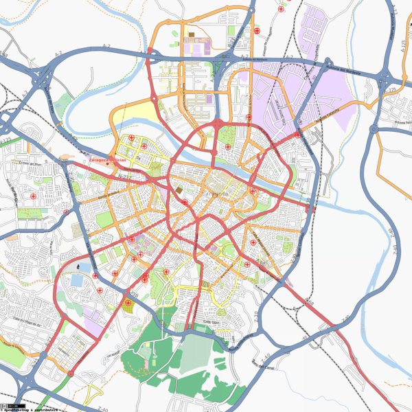
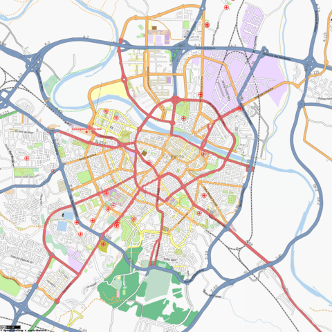
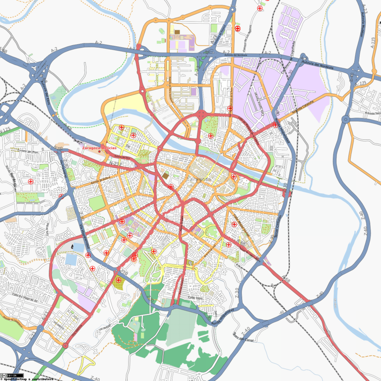
Map of Zaragoza in OpenStreetMap (2010-03-22) (last snapshot was File:Zaragoza-August2009.png.
Map of Zaragoza
This map and others like it, were created by OpenStreetmap contributors, and are licensed as Creative Commons CC-BY-SA 2.0 (https://creativecommons.org/licenses/by-sa/2.0/) (see OpenStreetMap licence).
Use {{mapof|PlaceName}} to add this template to your images.
This map and others like it, were created by OpenStreetmap contributors, and are licensed as Creative Commons CC-BY-SA 2.0 (https://creativecommons.org/licenses/by-sa/2.0/) (see OpenStreetMap licence).
Use {{mapof|PlaceName}} to add this template to your images.
File history
Click on a date/time to view the file as it appeared at that time.
| Date/Time | Thumbnail | Dimensions | User | Comment | |
|---|---|---|---|---|---|
| current | 14:31, 22 March 2010 | | 1,300 × 1,300 (1.4 MB) | Jynus (talk | contribs) | *[http://tah.openstreetmap.org/MapOf/?lat=41.65&long=-0.883333&z=14&w=1300&h=1300&format=png Source] Map of Zaragoza in OpenStreetMap (2010-03-22) (last snapshot was File:Zaragoza-August2009.png. {{mapof|Zaragoza}} |
You cannot overwrite this file.
File usage
The following 2 pages use this file: