File:Zlant parking lanes view.png

Original file (1,980 × 1,312 pixels, file size: 2.29 MB, MIME type: image/png)
Summary
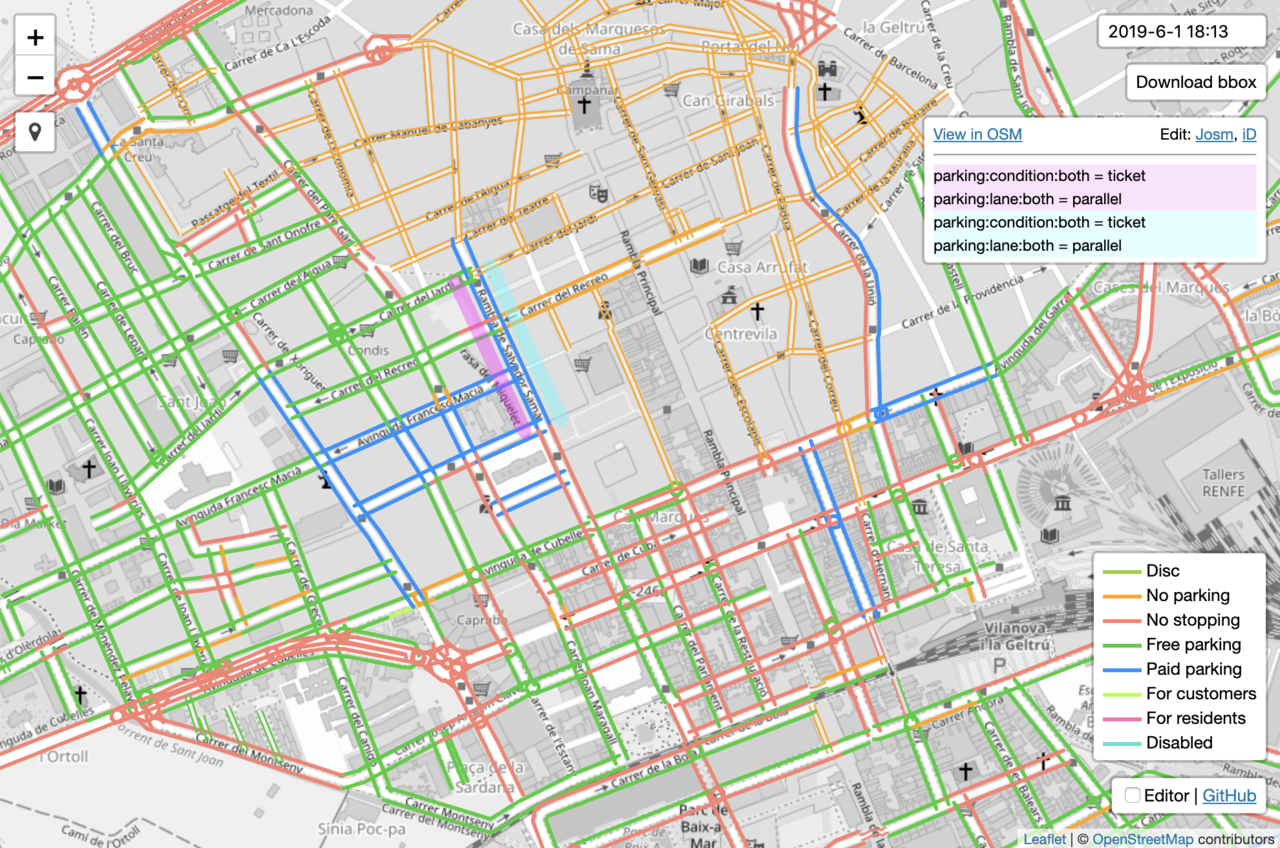
Screenshot of https://zlant.github.io/parking-lanes/#16/41.2225/1.7246 , a map showing Key:parking:lane data.
Read more on this diary entry by User:acsd
The featured location is Vilanova i la Geltrú. This rich spot of parking lanes data seems to have been mapped 5 years ago by yopaseopor e.g. changeset
Licensing
Map data OpenStreetMap. Screenshot by Harry who claims no additional copyright.
![]()
![]()
![]()
Attribution not specified as a parameter! THIS LICENSE ALWAYS REQUIRES ATTRIBUTION! Use {{CC-BY-SA-4.0|Attribution, typically name of author}} See Template:CC-BY-SA-4.0 for full description this template should be used.
| Contains map data © OpenStreetMap contributors, made available under the terms of the Open Database License (ODbL).
The ODbL does not require any particular license for maps produced from ODbL data, produced maps may be subject also to other licences. |
The website software is MIT licensed. Code repo: https://github.com/zlant/parking-lanes
File history
Click on a date/time to view the file as it appeared at that time.
| Date/Time | Thumbnail | Dimensions | User | Comment | |
|---|---|---|---|---|---|
| current | 21:36, 4 June 2019 | | 1,980 × 1,312 (2.29 MB) | Harry Wood (talk | contribs) | https://zlant.github.io/parking-lanes/#16/41.2225/1.7246 |
You cannot overwrite this file.
File usage
The following 7 pages use this file: