Key:building:levels:underground
Jump to navigation
Jump to search
| Description |
|---|
| To mark number of levels under ground level |
| Group: buildings |
| Used on these elements |
| Requires |
| Useful combination |
| See also |
| Status: in use |
| Tools for this tag |
|
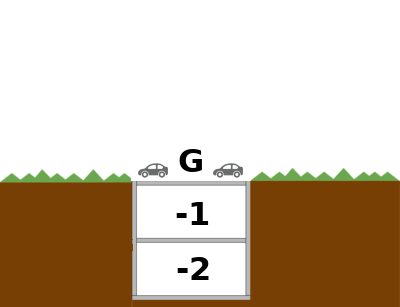
This tag is used for marking the number of underground levels of a building (building=*) or of a building part (building:part=yes).
For more information, see building:levels=*.
How to map
Use the tag on a closed way ![]() in combination with building=*. The value of building:levels:underground=* must be a non-negative integer (i. e. 0 or greater).
in combination with building=*. The value of building:levels:underground=* must be a non-negative integer (i. e. 0 or greater).
Do not use negative values! For above-ground building parts without connection to the ground, use building:min_level=* instead.
Examples
| building:levels:underground=* | Meaning |
|---|---|
| 0 | no underground levels |
| 1 | one level underground |
| 2 | two levels underground |
   amenity=parking
   building=parking
   parking=multi-storey
   building:levels=0
   building:levels:underground=2

