3D: Difference between revisions
m (→Desktop apps: update link) |
Lectrician1 (talk | contribs) (add worldwind Kotlin) |
||
| Line 15: | Line 15: | ||
: Quick access to demonstration areas is available on [[3D Demo Areas|3D Demo Areas page]]. |
: Quick access to demonstration areas is available on [[3D Demo Areas|3D Demo Areas page]]. |
||
=== |
=== Multiplatform === |
||
{| class="wikitable sortable sticky" border="1" |
|||
|- |
|||
!Name |
|||
!External Link |
|||
!Description |
|||
!Freely Licensed? |
|||
!Application Type |
|||
|- |
|||
|WorldWindKotlin |
|||
|[https://github.com/WorldWindEarth/WorldWindKotlin GitHub] |
|||
|3D virtual globe. Can display information in 3D or 2D. Can take geographic information from different sources. |
|||
| {{yes|free}} - Apache License, Version 2.0 |
|||
|Android, Web, Java |
|||
|} |
|||
===Websites=== |
|||
{| class="wikitable sortable sticky" border="1" |
{| class="wikitable sortable sticky" border="1" |
||
|- |
|- |
||
!Screenshot |
!Screenshot |
||
! |
!OSM Wiki Link |
||
! |
!External Link |
||
! |
!Description |
||
! Freely Licensed? |
! Freely Licensed? |
||
! |
!Application Type |
||
|- |
|- |
||
| |
|[[File:F4 3d Screenshot.png|frameless|150x150px]] |
||
| |
|[[F4 Map]] |
||
| |
|[http://demo.f4map.com Map] |
||
| |
|WebGL realtime render - with fountains, trees, meteo, shadows based on real sun/moon position |
||
| {{no|nonfree}} - terms at the bottom of [https://f4map.com/#footer their site] in French |
| {{no|nonfree}} - terms at the bottom of [https://f4map.com/#footer their site] in French |
||
| |
|Webapp |
||
|- |
|- |
||
| |
|[[File:MSN Rostok 3D.png|frameless|150x150px]] |
||
| |
|[[MapSurfer]] |
||
|<ul> |
|<ul> |
||
<li>[https://github.com/MapSurferNET Github]</li> |
<li>[https://github.com/MapSurferNET Github]</li> |
||
<li>[http://mapsurfernet.com/demo/live Map]</li> |
<li>[http://mapsurfernet.com/demo/live Map]</li> |
||
</ul> |
</ul> |
||
| |
|Only building heights |
||
Website domain is no longer active |
Website domain is no longer active |
||
| |
| |
||
? |
|||
| |
|Webapp |
||
|- |
|- |
||
| [[File:MapboxOutdoors.jpg|frameless|150x150px]] |
| [[File:MapboxOutdoors.jpg|frameless|150x150px]] |
||
| |
|[[MapBox]] |
||
|<ul> |
|<ul> |
||
<li>[https://www.mapbox.com/ Website]</li> |
<li>[https://www.mapbox.com/ Website]</li> |
||
<li>[https://www.mapbox.com/mapbox-gl-js/example/3d-buildings/ Map]</li> |
<li>[https://www.mapbox.com/mapbox-gl-js/example/3d-buildings/ Map]</li> |
||
</ul> |
</ul> |
||
| |
| |
||
| |
|a? |
||
| |
|Webapp |
||
|- |
|- |
||
| [[File:OSMB-Manhattan.png|frameless|150x150px]] |
| [[File:OSMB-Manhattan.png|frameless|150x150px]] |
||
| [[OSMBuildings]] |
| [[OSMBuildings]] |
||
| |
| |
||
* |
*[https://github.com/OSMBuildings/OSMBuildings Github] |
||
* |
*[http://osmbuildings.org/ Map] |
||
|WebGL viewer - also available as [https://github.com/OSMBuildings/OSMBuildingsClassic Classic] Version for visualizing on interactive maps |
|WebGL viewer - also available as [https://github.com/OSMBuildings/OSMBuildingsClassic Classic] Version for visualizing on interactive maps |
||
| {{yes|free}} - [https://github.com/OSMBuildings/OSMBuildings/blob/master/LICENSE.md composed of parts with different free licenses] |
| {{yes|free}} - [https://github.com/OSMBuildings/OSMBuildings/blob/master/LICENSE.md composed of parts with different free licenses] |
||
| |
|Webapp |
||
|- |
|- |
||
| |
|[[File:OSMgoScreenshot.png|frameless|150x150px]] |
||
| |
|[[OSM go]] |
||
| |
|[http://www.osmgo.org/map/ Map] |
||
| |
| |
||
| |
|o? |
||
| |
|Webapp |
||
|- |
|- |
||
| |
|[[File:Osm3d frankfurt2.jpg|frameless|150x150px]] |
||
| |
|[[OSM-3D.org]] |
||
| |
|[http://www.osm-3d.org/map.htm Map] |
||
| |
|Only building heights. |
||
Needs Java-plugin 1.6 or older to show. |
Needs Java-plugin 1.6 or older to show. |
||
| ? |
| ? |
||
| |
|Webapp (Java) |
||
|- |
|- |
||
| |
|[[File:Wma webglbuildings.png|frameless|150x150px]] |
||
| |
|[[WikiMiniAtlas]] |
||
| |
|[https://wma.wmflabs.org Map] |
||
| |
|Integrated in Wikipedia. |
||
| {{yes|free}} - [https://meta.wikimedia.org/wiki/WikiMiniAtlas#License_Stuff GPLv3+] |
| {{yes|free}} - [https://meta.wikimedia.org/wiki/WikiMiniAtlas#License_Stuff GPLv3+] |
||
| |
|Webapp |
||
|- |
|- |
||
|[[File:Vizicities.png|center|frameless|147x147px]] |
|[[File:Vizicities.png|center|frameless|147x147px]] |
||
| Line 89: | Line 106: | ||
|<ul> |
|<ul> |
||
<li>[https://github.com/robhawkes/vizicities GitHub]</li> |
<li>[https://github.com/robhawkes/vizicities GitHub]</li> |
||
<li>[http://vizicities.apps.rawk.es/demo.html Map]</li> |
<li> [http://vizicities.apps.rawk.es/demo.html Map] </li> |
||
</ul> |
</ul> |
||
| |
|WebGL dynamic OpenStreetMap visualisation platform + live transport and data overlays |
||
| {{yes|free}} - [https://github.com/robhawkes/vizicities/blob/dev/LICENSE BSD 3-clause] |
| {{yes|free}} - [https://github.com/robhawkes/vizicities/blob/dev/LICENSE BSD 3-clause] |
||
| |
|Webapp |
||
|- |
|- |
||
|[[File:Scene layers.jpg|thumb]] |
|[[File:Scene layers.jpg|thumb]] |
||
|[[Esri]] |
|[[Esri]] |
||
|[https://www.arcgis.com/home/group.html?id=337346d491064d7aa7d455cfba5e6a44#overview Esri OSM Scene Layers] |
| [https://www.arcgis.com/home/group.html?id=337346d491064d7aa7d455cfba5e6a44#overview Esri OSM Scene Layers] |
||
|These 3D scene layers feature global buildings and trees, with trees presented in two styles (realistic and thematic). These scene layers can be used in Scene Viewer, ArcGIS Pro, and other ArcGIS apps that support 3D visualization. |
|These 3D scene layers feature global buildings and trees, with trees presented in two styles (realistic and thematic). These scene layers can be used in Scene Viewer, ArcGIS Pro, and other ArcGIS apps that support 3D visualization. |
||
|Custom license |
|Custom license |
||
|Web layers |
|Web layers |
||
|} |
|} |
||
=== |
===Desktop apps=== |
||
{| class="wikitable sortable sticky" border="1" |
{| class="wikitable sortable sticky" border="1" |
||
|- |
|- |
||
!Screenshot |
! Screenshot |
||
! |
!OSM Wiki Link |
||
! |
!External Link |
||
! |
!Description |
||
! |
!Freely Licensed? |
||
! |
!Application Type |
||
|- |
|- |
||
|[[File:Flightgear 2018.3 - Madrid, Spain at dawn with OSM2City output.jpg|alt=FlightGear - Buildings and objects in Madrid, Spain generated from OpenStreetMap data in Flightgear 2018.|frameless|150x150px]] |
|[[File:Flightgear 2018.3 - Madrid, Spain at dawn with OSM2City output.jpg|alt=FlightGear - Buildings and objects in Madrid, Spain generated from OpenStreetMap data in Flightgear 2018.|frameless|150x150px]] |
||
|[[FlightGear]] |
|[[FlightGear]] |
||
|[https://www.flightgear.org/download/ FlightGear.org download] |
|[https://www.flightgear.org/download/ FlightGear.org download] |
||
|Flight simulator : Accurate Earth model (oblate spheriod). Real-time rendering, accurate daylight and sky from celestial simulation. |
|Flight simulator : Accurate Earth model (oblate spheriod). Real-time rendering, accurate daylight and sky from celestial simulation. |
||
Realistic weather and atmosphere rendering. Simulated environment, seasons. Detailed weather simulation with features like snow and rain build-up on OSM objects. OSM objects are downloaded as you fly in FlightGear 2020.3.7 LTS or later. |
Realistic weather and atmosphere rendering. Simulated environment, seasons. Detailed weather simulation with features like snow and rain build-up on OSM objects. OSM objects are downloaded as you fly in FlightGear 2020.3.7 LTS or later. |
||
| Line 126: | Line 143: | ||
|Desktop |
|Desktop |
||
|- |
|- |
||
| |
|[[File:Blender-osm 2016-11-15.png|frameless|150x150px]] |
||
| |
|[[blender-osm]] |
||
|<ul> |
|<ul> |
||
<li>[https://gumroad.com/l/blender-osm $5.90 on Gumroad]</li> |
<li>[https://gumroad.com/l/blender-osm $5.90 on Gumroad]</li> |
||
<li>[https://github.com/vvoovv/blender-osm GitHub]</li> |
<li>[https://github.com/vvoovv/blender-osm GitHub]</li> |
||
</ul> |
</ul> |
||
| |
|A [[Blender]] plugin |
||
| {{yes|}} pay-for-source (once paid, licensed under GPL [version not specified]) |
| {{yes|}} pay-for-source (once paid, licensed under GPL [version not specified]) |
||
| Desktop (plugin) |
| Desktop (plugin) |
||
|- |
|- |
||
| |
|[[File:Generation_Streets_Screenshot.jpg|frameless|150x150px]] |
||
| |
|[[Generation Streets]] |
||
|<ul> |
|<ul> |
||
<li>[https://store.steampowered.com/app/887970/Generation_Streets/ Free on Steam]</li> |
<li>[https://store.steampowered.com/app/887970/Generation_Streets/ Free on Steam]</li> |
||
<li>[https://github.com/romanshuvalov/rsgeotools GitHub]</li> |
<li>[https://github.com/romanshuvalov/rsgeotools GitHub]</li> |
||
</ul> |
</ul> |
||
| |
|A video game and a separated command-line tool |
||
| {{Partial|}} Video game: proprietary,<br/>Command-line tool: free, licensed under BSD |
| {{Partial|}} Video game: proprietary,<br/>Command-line tool: free, licensed under BSD |
||
| |
|Desktop |
||
|- |
|- |
||
| |
|[[File:Kendzi3d more complex roof.png|frameless|150x150px]] |
||
| |
|[[Kendzi3d]] |
||
|<ul> |
|<ul> |
||
<li>[https://josm.openstreetmap.de/ Website]</li> |
<li>[https://josm.openstreetmap.de/ Website]</li> |
||
<li>[https://github.com/kendzi/kendzi3d GitHub]</li> |
<li>[https://github.com/kendzi/kendzi3d GitHub] </li> |
||
</ul> |
</ul> |
||
| |
|3D Renderer part of [[JOSM]] Map editor |
||
| {{yes|free}} probably - claims BSDv3 but does not include license file |
| {{yes|free}} probably - claims BSDv3 but does not include license file |
||
| |
|Desktop |
||
|- |
|- |
||
| |
|[[File:OSM2World-Luebeck-Hauptbahnhof.jpg|frameless|150x150px]] |
||
| |
|[[OSM2World]] |
||
|<ul> |
|<ul> |
||
<li>[http://osm2world.org/ Website]</li> |
<li>[http://osm2world.org/ Website]</li> |
||
| Line 164: | Line 181: | ||
| |
| |
||
| {{yes|free}} - GNU LGPL |
| {{yes|free}} - GNU LGPL |
||
| |
|Desktop |
||
|} |
|} |
||
=== |
===Mobile apps=== |
||
{| class="wikitable sortable sticky" border="1" |
{| class="wikitable sortable sticky" border="1" |
||
|- |
|- |
||
!Screenshot |
!Screenshot |
||
! |
!OSM Wiki Link |
||
! |
!External Link |
||
! |
!Description |
||
! |
!Freely Licensed? |
||
! |
!Application Type |
||
|- |
|- |
||
| [[File:OpenStreetMap-OSM-3D-Android-OSG-Map-20.png|frameless|201x201px]] |
| [[File:OpenStreetMap-OSM-3D-Android-OSG-Map-20.png|frameless|201x201px]] |
||
| |
|[[OSG-Maps]] |
||
| [https://play.google.com/store/apps/details?id=com.osgexplorer Android (Play Store)] |
| [https://play.google.com/store/apps/details?id=com.osgexplorer Android (Play Store)] |
||
| |
|for Android |
||
|? |
|? |
||
| |
|Mobile<!-- |
||
|- |
|- |
||
| [[File:Maps.me android screenshot 2018-01.png|frameless|267x267px]] |
| [[File:Maps.me android screenshot 2018-01.png|frameless|267x267px]] |
||
| Line 198: | Line 215: | ||
|} |
|} |
||
== Exporting |
== Exporting== |
||
For artists, it might be interesting to get city models in common 3D formats as .OBJ |
For artists, it might be interesting to get city models in common 3D formats as .OBJ |
||
* |
*[[Blender]] |
||
* [https://halfmaps.github.io Phototiler] |
* [https://halfmaps.github.io Phototiler] |
||
* |
*[https://github.com/karimnaaji/vectiler Vectiler] |
||
* |
*[[OSM2World]] |
||
* [[Osm2pov]] |
* [[Osm2pov]] |
||
* |
*[https://github.com/mkagenius/osm2maya osm2maya] |
||
* [[3D printing OSM data]] |
* [[3D printing OSM data]] |
||
== |
==Mapping== |
||
The process of detailed recording your environment for later modelling is called [[micromapping]] in general. To get a lot of details very quickly, the [[Photomapping]] technique is recommend.<br> |
The process of detailed recording your environment for later modelling is called [[micromapping]] in general. To get a lot of details very quickly, the [[Photomapping]] technique is recommend.<br> |
||
Instead of taking your own photos (from top of tall buildings), you can watch for your area at [http://commons.wikimedia.org Wikipedia Commons] or ask e.g. [http://en.wikipedia.org/wiki/Wireless_community_network Wireless Community networks]. Some further image services, which are worth to check: |
Instead of taking your own photos (from top of tall buildings), you can watch for your area at [http://commons.wikimedia.org Wikipedia Commons] or ask e.g. [http://en.wikipedia.org/wiki/Wireless_community_network Wireless Community networks]. Some further image services, which are worth to check: |
||
* |
*[http://commons.wikimedia.org Wikimedia commons] |
||
* |
*[http://www.flickr.com Flickr] |
||
* |
*[[Mapillary]] |
||
* |
*[https://www.google.com/imghp Google image search] |
||
* |
*[https://ccsearch.creativecommons.org/ Creative Commons search] |
||
'''Notice: '''Please note that the sources must be qualified by their license for use. See for example [[:Category:Data Licenses]]. |
'''Notice: '''Please note that the sources must be qualified by their license for use. See for example [[:Category:Data Licenses]]. |
||
=== |
===Tagging === |
||
The 3D models can either be created using OSM itself (i.e. through the simple 3D buildings), or use externally created models that utilize external storage. |
The 3D models can either be created using OSM itself (i.e. through the simple 3D buildings), or use externally created models that utilize external storage. |
||
* [[Simple 3D Buildings]] |
* [[Simple 3D Buildings]] |
||
* [[3D tagging]] |
* [[3D tagging]] |
||
* |
*[[3D Model Repository]] |
||
* |
*[[OpenBuildingModels]] (not widely supported) |
||
Additional list of 3D tagging applications can be found on [[Simple 3D buildings#Editing tools|Simple 3D buildings page]]. |
Additional list of 3D tagging applications can be found on [[Simple 3D buildings#Editing tools|Simple 3D buildings page]]. |
||
== |
==Development== |
||
You are interested in embedding 3D functionality in your own software? |
You are interested in embedding 3D functionality in your own software? |
||
* |
*[[3D Development]] |
||
== |
==See also== |
||
* |
*[[Template:User 3d]] - if you like 3D and want to show it on your wiki userpage |
||
* |
*[[List of OSM-based services|Full list of OSM-based services]] |
||
== |
==Notable dead projects== |
||
* |
*[[Open Earth View]] |
||
* |
*[[OpenScienceMap]] |
||
[[Category:3D]] |
[[Category:3D]] |
||
Revision as of 16:56, 16 October 2022
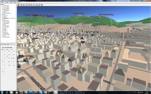
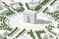
The third dimension is a growing topic at OSM. It's already possible to add detailed buildings and a lot of minor objects, which results in a 'feeling like home'.
Viewing
If you just want to browse 3D city models, you can view them with multiple tools.
- See also
- A similar list of map applications can be found on Simple 3D buildings page.
- Demonstration areas
- Quick access to demonstration areas is available on 3D Demo Areas page.
Multiplatform
| Name | External Link | Description | Freely Licensed? | Application Type |
|---|---|---|---|---|
| WorldWindKotlin | GitHub | 3D virtual globe. Can display information in 3D or 2D. Can take geographic information from different sources. | free - Apache License, Version 2.0 | Android, Web, Java |
Websites
| Screenshot | OSM Wiki Link | External Link | Description | Freely Licensed? | Application Type |
|---|---|---|---|---|---|
|
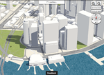
F4 Map | Map | WebGL realtime render - with fountains, trees, meteo, shadows based on real sun/moon position | nonfree - terms at the bottom of their site in French | Webapp |
|
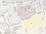
MapSurfer | Only building heights
Website domain is no longer active |
? |
Webapp | |
|
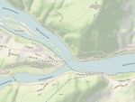
MapBox | a? | Webapp | ||
|
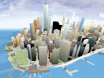
OSMBuildings | WebGL viewer - also available as Classic Version for visualizing on interactive maps | free - composed of parts with different free licenses | Webapp | |

|
OSM go | Map | o? | Webapp | |

|
OSM-3D.org | Map | Only building heights.
Needs Java-plugin 1.6 or older to show. |
? | Webapp (Java) |
|
WikiMiniAtlas | Map | Integrated in Wikipedia. | free - GPLv3+ | Webapp |
| Vizicities | WebGL dynamic OpenStreetMap visualisation platform + live transport and data overlays | free - BSD 3-clause | Webapp | ||
| Esri | Esri OSM Scene Layers | These 3D scene layers feature global buildings and trees, with trees presented in two styles (realistic and thematic). These scene layers can be used in Scene Viewer, ArcGIS Pro, and other ArcGIS apps that support 3D visualization. | Custom license | Web layers |
Desktop apps
| Screenshot | OSM Wiki Link | External Link | Description | Freely Licensed? | Application Type |
|---|---|---|---|---|---|

|
FlightGear | FlightGear.org download | Flight simulator : Accurate Earth model (oblate spheriod). Real-time rendering, accurate daylight and sky from celestial simulation.
Realistic weather and atmosphere rendering. Simulated environment, seasons. Detailed weather simulation with features like snow and rain build-up on OSM objects. OSM objects are downloaded as you fly in FlightGear 2020.3.7 LTS or later. Notes on realistic renders to showcase OSM: Some learning to configure environment & weather. FlightGear is a research quality simulator first, with an FDM engine that was used by NASA to set a benchmark - so expect a bit of learning curve. However, if you need realistic renders or a moving camera video with realistic weather and environment to showcase OSM data, FlightGear can produce it when configured properly - see their wiki for tips. Try 'UFO' viewer or 'video assistant'. A powerful GPU and CPU is needed for high quality renders with large view distances. The official scenery sources provide a pre-built world. Areas with no OSM coverage may be set to be auto-generated. If you need a more recent build, or different settings, you need to build it. |
free - GNU GPL | Desktop |
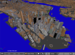
|
blender-osm | A Blender plugin | pay-for-source (once paid, licensed under GPL [version not specified]) | Desktop (plugin) | |
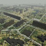
|
Generation Streets | A video game and a separated command-line tool | Video game: proprietary, Command-line tool: free, licensed under BSD |
Desktop | |
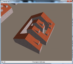
|
Kendzi3d | 3D Renderer part of JOSM Map editor | free probably - claims BSDv3 but does not include license file | Desktop | |

|
OSM2World | free - GNU LGPL | Desktop |
Mobile apps
| Screenshot | OSM Wiki Link | External Link | Description | Freely Licensed? | Application Type |
|---|---|---|---|---|---|
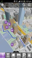
|
OSG-Maps | Android (Play Store) | for Android | ? | Mobile |
Exporting
For artists, it might be interesting to get city models in common 3D formats as .OBJ
Mapping
The process of detailed recording your environment for later modelling is called micromapping in general. To get a lot of details very quickly, the Photomapping technique is recommend.
Instead of taking your own photos (from top of tall buildings), you can watch for your area at Wikipedia Commons or ask e.g. Wireless Community networks. Some further image services, which are worth to check:
Notice: Please note that the sources must be qualified by their license for use. See for example Category:Data Licenses.
Tagging
The 3D models can either be created using OSM itself (i.e. through the simple 3D buildings), or use externally created models that utilize external storage.
- Simple 3D Buildings
- 3D tagging
- 3D Model Repository
- OpenBuildingModels (not widely supported)
Additional list of 3D tagging applications can be found on Simple 3D buildings page.
Development
You are interested in embedding 3D functionality in your own software?
See also
- Template:User 3d - if you like 3D and want to show it on your wiki userpage
- Full list of OSM-based services
