Key:highway
Key Name: highway
Applying to Map Features type: Physical
Core values
- motorway
- motorway_link
- trunk
- primary
- secondary
- tertiary
- unclassified
- residential
- bridleway
- cycleway
- footway
- steps
User Defined values
Any valid syntax value other than a core value
Examples:
| Key | Value | Element | Comment | Example |
|---|---|---|---|---|
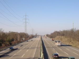
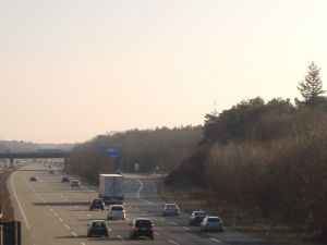
| highway | motorway | A restricted access major divided highway, normally with 2 or more running lanes plus emergency hard shoulder. Equivalent to the Freeway, Autobahn etc.. | File:Motorway-photo.jpg | |
| highway | motorway_link | The link roads (sliproads / ramps) leading to and from a motorway. Normally with the same motorway restrictions. .. | 
| |
| highway | trunk | Important roads that aren't motorways. Typically maintained by central, not local government. Need not necessarily be a divided highway. In the UK, many 2digit "A" roads (eg A34) were formally designated Trunk roads although that definition is no longer absolute... | 
| |
| highway | trunk_link | The link roads (sliproads / ramps) leading to and from a trunk road. .. | 
| |
| highway | primary | Administrative classification in the UK, generally linking larger towns. | 
| |
| highway | primary_link | The link roads (sliproads / ramps) leading to and from a primary road. | ||
| highway | secondary | Administrative classification in the UK, generally linking smaller towns and villages | 
| |
| highway | tertiary | A "C" road in the UK. Generally for use on roads wider than 4 metres (13') in width, and for faster/wider minor roads that aren't A or B roads. In the UK, they tend to have dashed lines down the middle, whereas unclassified roads don't. | 
| |
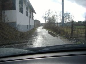
| highway | unclassified | No administrative classification. Unclassified roads typically form the lowest form of the interconnecting grid network. Note: This is not a marker for roads where we still need to choose a highway tag. |

| |
| highway | track | unpaved/unsealed roads for agricultural use; gravel roads in the forest etc. | 
| |
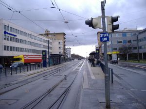
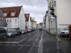
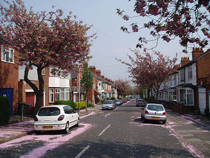
| highway | residential | roads accessing or around residential areas but which are not a classified or unclassified highway. | 
| |
| highway | service | generally for access to a building, motorway service station, beach, campsite, industrial estate, business park, etc. This is also commonly used for access to parking and trash collection. Sometimes called an alley, particularly in the US. | 
| |
| highway | bridleway | For horses, (in the UK, generally footpaths on which horses are also permitted) | 
| |
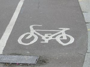
| highway | cycleway | For designated cycleways, i.e. mainly/exclusively for bicycles. If pedestrians are allowed as well, you can indicate this by adding a foot=yes tag. Note: names are not rendered currently. | 
| |
| highway | footway | For designated footpaths, i.e. mainly/exclusively for pedestrians. This includes walking tracks and gravel paths. If bicycles are allowed as well, you can indicate this by adding a bicycle=yes tag. Note: names are not rendered currently. | 
| |
| highway | pedestrian | For Roads , i.e. mainly/exclusively for pedestrians /Shopping Areas | ||
| highway | steps | For flights of steps on footways | 
| |
| highway | mini_roundabout | Very small roundabouts only, larger ones should be junction=roundabout. In the UK, mini-roundabouts have a circular sign with a blue background, instead of the usual triangular sign | 
| |
| highway | stop | A stop sign | ||
| highway | traffic_signals | Lights that control the traffic | ||
| highway | crossing | Pedestrians can cross a street here - e.g. zebra crossing | ||
| highway | gate | |||
| highway | stile | Allow pedestrians to cross a wall or fence | 
| |
| highway | cattle_grid | Bars in the road surface that allow wheeled vehicles but not animals to cross. Sometimes known as a Texas Gate, even outside of Texas | ||
| highway | toll_booth | A road usage toll or fee is collected here | ||
| highway | incline | A slope or hill, may encounter slow moving trucks | ||
| highway | incline_steep | Just as incline, only steeper | ||
| highway | viaduct | A high and/or long bridge - more commonly carries water or trains (but see also waterway=aqueduct) | ||
| highway | motorway_junction | Indicates a junction (UK) or exit (US) ref should be set to the exit number or junction identifier. (Some roads - e.g. the A14 - also carry junction numbers, so the tag may be encountered elsewhere despite its name) | ||
| highway | services | A service station to get food and eat something, often found at motorways | ||
| highway | ford | The road crosses a stream or river, vehicles must enter the water node | 
| |
| highway | bus_stop | A small bus stop. Larger stations should be tagged as amenity=bus_station instead. | ||
| highway | User Defined | |||
| junction | roundabout | This automatically implies oneway=yes, the oneway direction is defined by the segment direction. This applies on a way, tagged with highway=<something> already. | 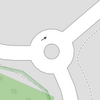
| |
| junction | User Defined |
| XML | Examples | Comments |
|---|---|---|
<tag k="highway" v="motorway"/>
|
For restricted access divided highways | |
<tag k="highway" v="motorway_link"/>
|
For link-lanes, motorway exits and other motorway side roads, where motorway traffic rules apply | |
<tag k="highway" v="trunk"/>
|
For unrestricted access divided highways and other inter regional routes | |
<tag k="highway" v="primary"/>
|
For primary roads. Equivalent to the British classification "A road" | |
<tag k="highway" v="secondary"/>
|
For secondary roads. Equivalent to the Swiss classification "2nd class", or British "B road" (2 lanes, wide enough for 2 passenger cars) | |
<tag k="highway" v="tertiary"/>
|
For tertiary roads. British "C road" (albeit hard to identify, normally a minor road >4m wide and with white dashed lines down the centre) | |
<tag k="highway" v="unclassified"/>
|
For minor and unclassified roads. Equivalent to Swiss classification "3rd class" (1 lane, wide enough for 1 truck).
Note: This does not mean we haven't classified the road. It is not a marker for roads where we still need to choose a highway tag | |
<tag k="highway" v="residential"/>
|
For residential streets. | |
<tag k="highway" v="bridleway"/>
|
For designated bridleways | |
<tag k="highway" v="cycleway"/>
|
For designated cycle paths | |
<tag k="highway" v="footway"/>
|
For designated footpaths | |
<tag k="highway" v="steps"/>
|
For flights of steps on footpaths and pedestrian routes |
Notes:
While certain legal designations are used in the descriptions and some of the tags are the same as legal descriptions, e.g. trunk and motorway, the consensus is that the highway tag is for making a general description of the physical attributes of a highway.
While it is not as specific as other tags it is very useful because a section of highway can be classified with this tag simply by looking at it. This allows a useful representation of the highway to be part of the map immediately until other data can be gathered.
While some highway tags like cycleway and bridleway imply a particular kind of traffic other tags should be used to designate what traffic is legally allowed or may be appropriate.
The highway tag is completely separate from network and route systems. In many countries a particular section of road may be part of many different routes in the same or different route networks, and a particular route may have sections with different attributes and therefore different highway tags. Routes are indicated by the ref tag.
Some roads that were legally classified as trunk roads have been "detrunked" and are no longer designated by the government as trunk roads. These roads should still have the tag highway=trunk.
May apply to:
- <node>s: Yes
- Lines <Segment>s: No
- <way>s: Yes
- <area>s: No
International equivalence
A brief, non-prescriptive guide to how highway values are assigned in different countries.
| Country | motorway | trunk | primary | secondary | tertiary | unclassified |
|---|---|---|---|---|---|---|
| UK | motorway | primary A road (green signs) | non-primary A road (black/white signs) | B road (black/white signs) | significant minor road (good surface, white lines) | less significant minor road |
| US | All divided paved roads with 2 or more lanes in each direction and access by ramps only. This includes almost all Interstate Highways except in very rural areas where there may be standard intersections. | Divided highway without ramps. Higher speeds. Few stop lights or stop signs. | Undivided highway without ramps. Higher speeds. Few stop lights or stop signs. | Wide main roads with stop signs and stop lights. | two lane local roads with or without center stripes | single lane roads |
| Korea | All divided paved roads with 2 or more lanes in each direction and access by ramps only. This includes all toll roads designated by a red and blue shield. | Divided highway without ramps. Higher speeds. Few stop lights or stop signs. | Undivided highway without ramps. Higher speeds. Few stop lights or stop signs. | Wide main roads with stop signs and stop lights. | two lane local roads with or without center stripes | single lane roads |
| Switzerland | Autobahn | Autostrasse | Hauptstrasse (blau) | Nebenstrasse (weiss) | - | alles andere |
| Switzerland | autoroute | autoroute de 2eme classe (semi-autoroute) | route de 1ere classe (bleu) | route de 2eme classe (blanc) | route de 3eme classe | chemin carossable |
| Australia | see Australian_Roads_Tagging | |||||
Last edit
Page created by Blackadder 11:39, 17 Mar 2006 (UTC) Latest update by Richard 10:58, 15 August 2007 (BST)
