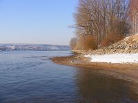
Tag:landcover=water
Jump to navigation
Jump to search
| Description |
|---|
| A water covered area. See more common tags: natural=water, waterway=riverbank, leisure=swimming_pool, landuse=reservoir, landuse=basin, natural=wetland |
| Group: landcover |
| Used on these elements |
| See also |
| Status: proposed |
| Tools for this tag |
|
The tag landcover=water is very rarely used to map water covered areas. It is usually applied to inland bodies of water rather parts of the sea which is outside of the natural=coastline . In most cases a more common tag such as natural=water is added as well, or more rarely waterway=riverbank, landuse=reservoir, landuse=basin, or leisure=swimming_pool. It is not commonly used with natural=wetland.
Usage of landcover=water is very small, its usage is thousands of times lower than of tags, and it is not currently supported by any major database users, such as publically available map renderings.
