Tag:natural=mountain_range
Zur Navigation springen
Zur Suche springen

 |
| Description |
|---|
| A mountain range, a series of high ridges and mountain peaks ranged in a line and connected by high ground |
| Group: natural |
| Used on these elements |
| Useful combination |
|
| See also |
| Status: in use |
| Tools for this tag |
|
natural=mountain_range is in use to tag a ![]() mountain range, a series of high ridges and mountain peaks ranged in a line and connected by high ground.
mountain range, a series of high ridges and mountain peaks ranged in a line and connected by high ground.
This tag has not been clearly defined, and has problems with Verifiability, especially for very large mountain ranges or when mapped as an area.
For individual mountain or hill ridges see the approved tags natural=ridge and natural=arete. For individual named peaks and mountain summits, see natural=peak.
Mapping
- As a node: place a node near the center of the mountain range and tag with natural=mountain_range. This is the most common way of mapping a mountain range
- As a line: draw a way along the crest of the mountain range. The way should follow the line of the individual natural=ridge ways along the highest crest of the range, and connect the main natural=peak and natural=saddle points. The way should not cross streams, rivers or valleys. This method of mapping is currently less popular, and has some problems with Verifiability if the line crosses a flat area or plateau.
- As an area? some mappers have drawn rough outlines of areas that they consider to be mountain ranges. However, the shape and size of these areas are usually not verifiable. One mapper might consider the mountain range to include all the foothills down to flat land, while another may only consider the highest parts of the mountain to be in the range, excluding any small valleys. For these reasons it is not recommended to map mountain ranges as areas.
- As a point cloud? During a December 2020 tagging list discussion, an experimental feature was created which demonstrated how to represent the Green Mountains
 Green Mountains as a relation of peak features.
Mountain ranges vs ridges
- Ridges are smaller, local features which make up a certain mountain or mountain range. A natural=ridge is a continuous elevated crest with a single ridgeline. A natural=ridge usually ends at a natural=peak or natural=saddle.
- Note that some languages may use the same word for a ridge and a long mountain range, eg "Sierra" from Spanish and "Serra" in Portuguese are used for long ridge-like mountain ranges, such as the Sierra Nevada in California, and for individual hill or mountain ridgelines. Some Sierras and Serras should be mapped as one or a few natural=ridge linear ways. The key difference is that a ridge has a continuous crest and a single ridgeline for the whole length of the feature. Mountain ranges usually consist of many smaller ridges.
Examples
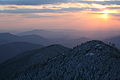
1. Cordillera de Mérida, Venezuela
.jpg)
Mapped as a node
* node 5653697322
* natural=mountain_range
* name = Cordillera de Mérida
2. Tin Range, New Zealand Mapped as a node
* node 973972064
* natural=mountain_range
* name = Tin Range

Mapped as a way
* OSM Way 624197209
* natural=mountain_range
* name = Sierra Madrona
Rendering
- OpenAndroMaps with Elevate theme
See also
- natural=ridge
- natural=arete - a knife-edged alpine ridge created between two glaciers
- natural=peak
- natural=saddle
- place=region + region:type=mountain_area
- Proposed features/Mountains
- Proposed features/ridge

Pennine Alps aerial view

Part of the Himalayas, showing many individual ridges and peaks
Great Smoky Mountains, Tennessee
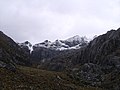
Sierra Nevada de Mérida, Venezuela


Panorama of the High Tatras mountain range from Poprad, Slovakia