Tag:tower:type=radar
Jump to navigation
Jump to search
| Description |
|---|
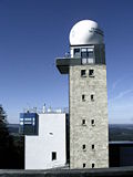
| Radar tower |
| Group: man made |
| Used on these elements |
| Useful combination |
| Status: de facto |
| Tools for this tag |
|
![]() Radar, the abbreviation of Radio Detection and Ranging, is the name for various detection and locating methods and devices based on electromagnetic waves in the radio frequency range.
Radar, the abbreviation of Radio Detection and Ranging, is the name for various detection and locating methods and devices based on electromagnetic waves in the radio frequency range.
How to map
Draw an area ![]() of the tower's outline or set a node
of the tower's outline or set a node ![]() at the centre.
at the centre.
Add the tags man_made=tower + tower:type=radar.
Tags to use in combination
Examples
| |
| |
| |
|


