Proposal talk:Road crossings
- I really like this proposal. it's a very good extension to "highway=traffic_signals" because the "highway=..." tells us something about the traffic flows with the way and the "crossing=..." tells us more about the art of traffic crossing the way.
- I add a "crossing=none" to be able to differ between "highway=traffic_signals" with and without "pedestrian crossings" --Cbm 05:25, 29 December 2007 (UTC)
- What exactly is the meaning of the bicycle, horse and segregated keys? Does horse=no mean that horses are not allowed to cross or only that they haven't been taken care of specifically (e.g. by adding a button in appropriate height)? Does segregated=yes mean there's effectively two or more crossing (with their own buttons) for people, horses, etc.? I suspect supervised=yes is supposed to mean "there's some human controlling the traffic". --Sascha silbe 12:38, 29 December 2007 (UTC)
- Proposal sounds reasonable, but (as Sascha also noted) the proposal should be a bit more verbose -- Ulfl 11:59, 31 December 2007 (UTC)
- here ar some examples for segregated crossings:
http://hilton.org.uk/cycling/vlaardingen/vlaardingen-09.jpg (traffic_signals)
http://hilton.org.uk/cycling/vlaardingen/vlaardingen-01.jpg (traffic_signals)
http://www.camcycle.org.uk/map/data/original/lle006.552819n52.998011a002m135o_20070920_115514.jpg (uncontrolled) - here are some examples for supervised crossings:
http://www.bbc.co.uk/threecounties/news/2002/07/16/lollipop340.jpg
http://www.st-egyden.at/Portals/0/Images/News/Sch%C3%BClerlotse1.JPG
- here ar some examples for segregated crossings:
- If those pictures show segregated crossings then a UK pelican crossing is not segregated, so the table in the proposal is wrong? Equally I believe a UK pelican crossing is technically bicycle=no - the whole point of a Toucan is that it's a Pelican with support for cycles surely? TomH 14:06, 2 January 2008 (UTC)
- don't now the situation in UK. feel free to chance the table above --Cbm 15:13, 2 January 2008 (UTC)
- Done. UK "pelican"s are indeed ped-only. UK "toucan"s can be used by cyclists and pedestrians, and are not segregated (i.e. the peds share space with cyclists when crossing) --achadwick 19:14, 2 April 2008 (BST)
- don't now the situation in UK. feel free to chance the table above --Cbm 15:13, 2 January 2008 (UTC)
- Proposal sounds reasonable, but (as Sascha also noted) the proposal should be a bit more verbose -- Ulfl 11:59, 31 December 2007 (UTC)
- Sorry if this is a stupid question, but is this tag meant to be put on the way (i.e. do I have to create a 4m long way segment for this tag), or do I just create a node at the place of the crossing and attach the data to the node? -- Semper 11:42, 2 January 2008 (UTC)
- IMHO, it's just a node you have to tag with "crossing=...", because the road itself is only one-dimensional at the moment, so the crossing just need to be a point on this line.
Example-crossings (best to see in JOSM at the moment):
http://www.informationfreeway.org/?lat=50.770309292367905&lon=6.10784168702345&zoom=17&layers=B000F000
http://www.informationfreeway.org/?lat=50.78319269777258&lon=6.127164316581574&zoom=17&layers=B000F000
http://www.informationfreeway.org/?lat=50.7690472198023&lon=6.057641473973778&zoom=17&layers=B000F000
- IMHO, it's just a node you have to tag with "crossing=...", because the road itself is only one-dimensional at the moment, so the crossing just need to be a point on this line.
- junction=* might be a better key, IMO. Some explanation of stuff like 'segregated' and 'supervised' would be very good. --Hawke 21:58, 27 March 2008 (UTC)
- In that they don't actually operate as a junction, I disagree. By definition, crossings are asymmetrical, allowing slower and more vulnerable traffic to pass by causing faster and less vulnerable traffic to stop. There's no joining or leaving, hence what's described isn't a junctions. The segregated/supervised stuff seems adequately documented now, thankfully; or at least I think I understand it. --achadwick 19:42, 2 April 2008 (BST)
- I don't see any change in the descriptions of segregated and supervised since I made the comment. In fact, I don't see any descriptions at all, just a couple of pictures. The pictures make 'supervised' less unclear, but do little to help with 'segregated'. All the images purportedly of segregated crossings appear to just show a simple crossing. And in any case a textual description would be good. --Hawke 14:55, 3 April 2008 (BST)
- I've added a textual description of each boolean "yes" value to the proposal. Could you review? Thanks. --achadwick 00:26, 10 April 2008 (BST)
- Awesome, that helps a lot. I added a note on what segregated means -- but shouldn't each part of the segregated crossing be mapped separately, with appropriate access tags, since they don't share physical space? --Hawke 17:55, 10 April 2008 (BST)
- Would this be node, way or area? I can see uses for node (small UK-style zebra crossing) or area (very large Tokyo pedestrian scrambles), but not for ways. --achadwick 19:42, 2 April 2008 (BST)
- Ways could be applicable where a crossing crosses a divided road. --Hawke 14:55, 3 April 2008 (BST)
- Hmm; if the crossing makes use of a pedestrian refuge island and the road is divided, isn't that really two separate
1-dimensional crossingsNodes? A matter of judgement for the individual mapper, I think. --achadwick 00:26, 10 April 2008 (BST)
- The thing is, when the road is indicated by two parallel lines, the point at which the crossing begins is different from where the road is. Crappy Ascii art:
- Hmm; if the crossing makes use of a pedestrian refuge island and the road is divided, isn't that really two separate
A B C D E
|-|-+-|-|
- A and E being sidewalk, B and D are carriageway centerlines, and C a pedestrian refuge, and the dashes representing the crossing. The line A-B-C would be a way which has to be a crossing, and the line C-D-E would be another way tagged as crossing. Does that make sense? --Hawke 17:55, 10 April 2008 (BST)
- Sorry about that. I fail at counting dimensions, and generated confusion. --achadwick
- It's always been my understanding that highways representing streets of the sort that road crossings appear on include their sidewalk as well as the main vehicle carriageway. That must be true of one-way highway Ways too, so any Way which crosses another Way at a crossing=* must do so at a single Node. You'd represent a split carriageway with two parallel Ways with oneway=yes in the appropriate direction, so that's at least two Nodes tagged as crossings:
- A and E being sidewalk, B and D are carriageway centerlines, and C a pedestrian refuge, and the dashes representing the crossing. The line A-B-C would be a way which has to be a crossing, and the line C-D-E would be another way tagged as crossing. Does that make sense? --Hawke 17:55, 10 April 2008 (BST)
   |   |      where      | and |     are 2 Ways with oneway=yes highway=secondary
   |   |
---+---+---    and     -----------    is 1 Way with highway=footway
   |   |
   |   |       and       + and +     are 2 Nodes with crossing=yes
- this makes a lot of sense if it's a cycleway or a footway crossing the road's Ways, but it's less clear if it's just a signalled crossing from one sidewalk on the left side of the left carriageway to the right side of the right carriageway. To me though, it makes more sense to enter this data as:
   |   |
   |   |      where  | and | and + and +
   +   +     carry the same meanings as above
   |   |
   |   |
- because (even if the +es were staggered), if they're close enough then most pedestrians would get the idea when reading the rendered map. There's a bit of an assumption here that pedestrians go where they choose by right of course: there's no offence of jaywalking in my country. Some mappers might think differently and represent a central pedestrian refuge with one or more Ways. I hope that makes sense. --achadwick 20:22, 25 April 2008 (UTC)
- Actually, thinking about it, what we can specify is that people should use the minimum number of dimensions necessary to get the job done. So that's a single Node for a crossing from one sidewalk to another, a single Node for a footway crossing a residential road, a short tagged Way for a pedestrian area crossing a road (assuming the pedestrians can gain priority somehow: otherwise it isn't a crossing in my book!), or an area if a pedestrian area ever crosses some future motorised area. --achadwick 00:26, 10 April 2008 (BST)
Elevated crossings
- Here in Belgium, we have crossings that are 'elevated', i.e. on top of sort of a speedbump. I don't think we have a tag for speedbumps yet. There are also entire intersections that are elevated. They differ from speedbumps in that they ara longer. Another way to reduce speed is to change the road's axis, forcing cars to turn a bit, or to narrow the street artificially. But I suppose that's another discussion.
Could we add elevated=yes/no, defaulting to no? Or is there a better term? Should I create a proposal page for speedbumps and other means of slowing down traffic?- Speedbumps are mentioned here:
http://wiki.openstreetmap.org/index.php/Proposed_features/barriers.
So a tagging example could be: "highway=crossing" "crossing=uncontrolled" "barrier=speedbump" --Cbm 12:48, 29 December 2007 (UTC)
- Speedbumps are mentioned here:
Additional types?
Besides traffic_signals, which is IMO wordy but clear, should values for signs be added, such as "stop" and "yield"? How would the signs' direction be indicated? e.g. a path crossing a road with stop signs for traffic on the path, but no sign for the road. --Hawke 21:38, 5 May 2008 (UTC)
- Based on the current proposal, I would assume that:
- Crossing traffic should* or must** stop unless told it's safe to go across, and that through traffic may go through unless told it must*** stop.
- * UK: pedestrians may go where they please, largely
- ** US areas with jay-walking laws?
- *** with specific legal force in all jurisdictions, as far as I'm aware
- But I don't see any reason to add more detailed co-tags right now; not sure the need is that pressing. Can you give me any specific examples of crossing types which do something different from my assumption? Would the sentence I've indented help clarify things?
- --achadwick 10:37, 6 May 2008 (UTC)
Is "uncontrolled" really uncontrolled?
In my city (in the USA), pedestrian crossings are indicated by white lines across the road, following the edges of the pedestrian route. The law says something like "drivers must stop for pedestrians in marked or unmarked crosswalks". For purposes of this tag: Are the lines considered "controls", or does that imply some sort of sign or light, making these crossings "uncontrolled"? Does crossing=no indicate that there is something preventing people from crossing there, or simply that there is no indication of any type that there is a crossing present? --Hawke 21:51, 5 May 2008 (UTC)
Sensible defaults
Defaulting to bicycle=no seems strange to me, for two reasons: One, all marked crossings that I'm aware of can be legally used by bicycles (you're not going to get cited for crossing on a bicycle at any crosswalk). Is it otherwise in the UK? Two, it is contrary to how access tags work everywhere else (defaulting to "yes" or perhaps "unknown" unless otherwise specified) --Hawke 21:51, 5 May 2008 (UTC)
- It is otherwise in the UK. bicycle=no is the default for all crossing traffic on crossings with the exception of the bike+ped Toucan crossings. "You're not going to get cited (issued with a Fixed Penalty Notice, fined, whatever)" is not the same thing as "it's legally OK to cross there by bike". While we're on the subject of UK-centric defaults, having segregated=* take no default is non-UK-centric (but also rather vague in a way I can live with). No crossing in the UK is segregated, to my knowledge, with the exception of the near-mythic horse+ped+bike ("centaur") ones. --achadwick 09:27, 6 May 2008 (UTC)
- Hawke for comparison, could you make a table listing what the Sensible Defaults would be in your part of the world? Thanks. --achadwick 09:27, 6 May 2008 (UTC)
Current usage
Do we need to respect current usage at all? IMcurrentO: yes, but only to the extent that tags can be automatically converted. Current usage has been documented: crossing=*; see the talk page for a detailed breakdown. --achadwick 11:05, 6 May 2008 (UTC)
Complaints within voting
moved from in the middle of votes
- I hate to break in to the voting for some discussion, but:
- The crossing tag is not already in widespread use (only 418 animal-based tags according to http://etricceline.de/osm/united-kingdom/tags.htm), and
- That usage is totally undocumented. I think there may have been some discussion on the mailing list at one point, but that's all I could find. And
- That usage is entirely UK-centric, while this one is both international and UK-compatible.
- Saying "it's already in use" is IMO not a valid argument for these reasons. --Hawke 23:37, 5 May 2008 (UTC)
- I've moved this away from the votes, since it will descend into chaos if this was to be discussed there. It's now documented at crossing=*, which you may find useful as reference. Gravitystorm 14:15, 6 May 2008 (UTC)
Types of pedestrian crossings
In Toronto, there are three types of pedestrian crossing:
- Crossings with signs and road markings only. These are rare in Toronto, but common in some other parts of Ontario.
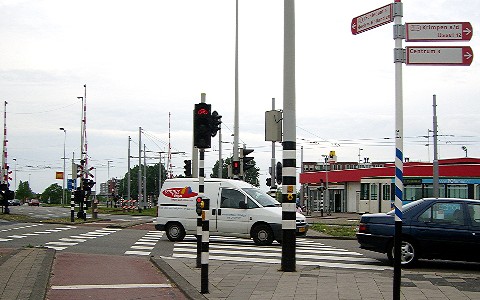
- Crossings with flashing yellow lights activated by a button, to warn cars. Example. These are by far the dominant type here in Toronto. I tag these highway=crossing.
- Crossings with traffic lights controlling the traffic, but no cross street. These are not all that common, but the city is gradually replacing type #2 with these to improve safety. I tag these highway=traffic_signals, but this proposal seems to suggest that I tag them differently (which I find confusing, since many traffic lights at cross streets are primarily intended as pedestrian crossings).
How should these be represented in OSM?