User talk:It's so funny
Thoughts on your connectivity proposal
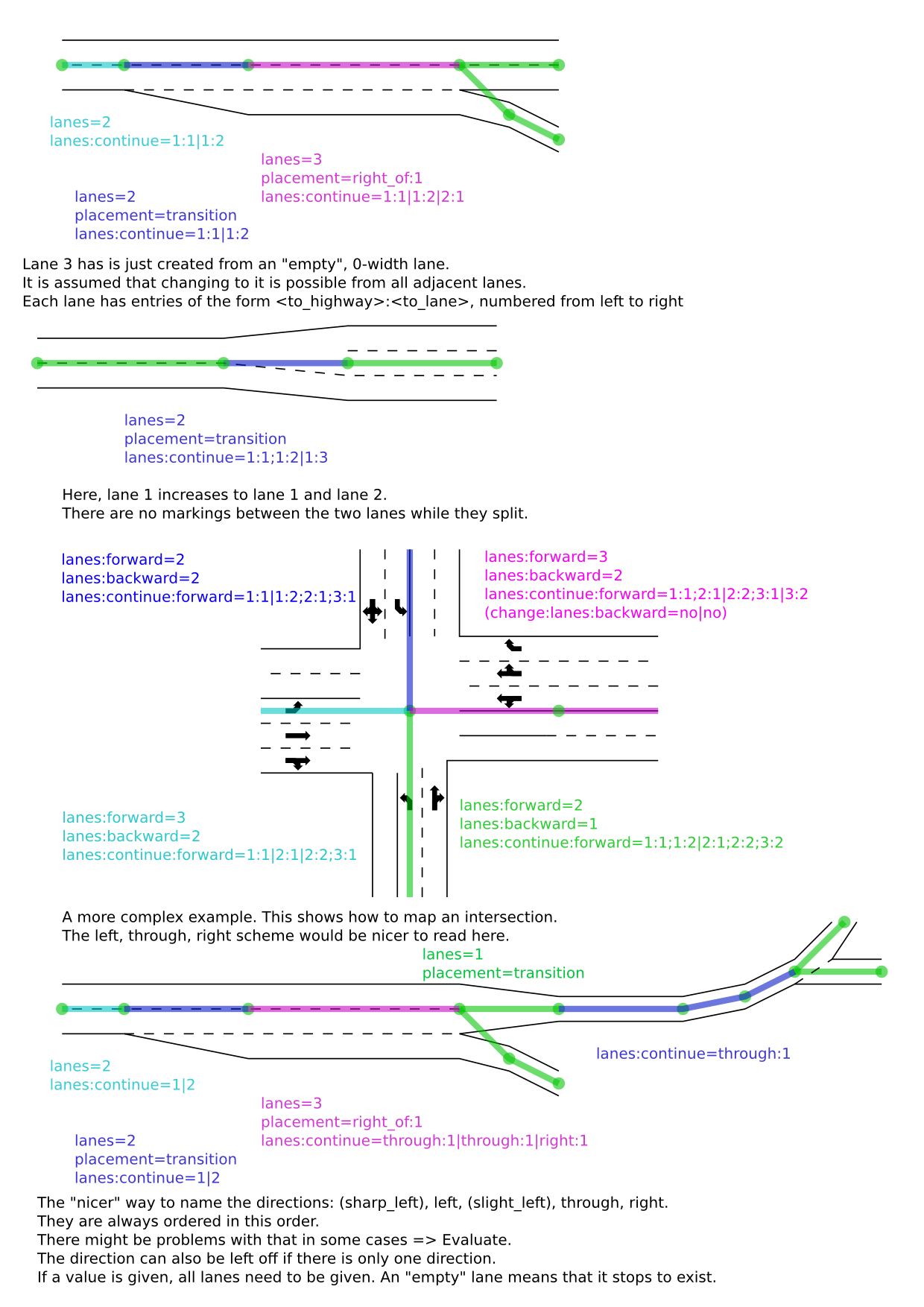
Hi, I also had some thoughts on your connectivity proposal. I would suggest an other value, that does specify which lane of this way connects to which line of the target lane. That way, one could also tag most (if not even all) intersections:
I think this scheme would be more easy to understand in most cases that you would need it (a simple highway-split where you do not know if there is just a new lane to the right or to the left). Whit this scheme, it would be possible to follow the lanes, and together with the change tag, an estimate how long the lane segments are and the full lane tag, the routing software can easily tell the user which lane to use best. That way, it should rarely be necessary to use a relation.
My current main problem is with the destinations: You could use names like left, through (or straight), ... here, but sometimes the user thinks that things are "through" while the computer cannot tell. Numbers have the advantage of being easy to use and understand, but they are difficult to maintain if someone changes the road geometry. And relations are so hard to understand that nobody uses them and everyone just breaks them.
What are your thoughts on this?
