Tag:amenity=bench
Jump to navigation
Jump to search
| Description |
|---|
| A place for people to sit, allowing room for one or more people. |
| Rendering in OSM Carto |
| Group: amenities |
| Used on these elements |
| Useful combination |
| Status: approved |
| Tools for this tag |
|
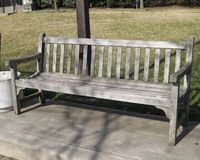
A place for people to sit, allowing room for one or more people. Benches are used for resting for an interval of time. They can be important to people with mobility impairments (e.g. needs a cane or crutches) who need a place to rest for a couple minutes while traveling on foot. Additionally, benches are often a suitable substitute for everyday activities like eating, reading, etc. when a picnic table is not available.
How to map
Use the tag amenity=bench on a node (typical) or a way (if tagging a unusually long bench or series of connected benches).
Tags used in combination
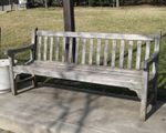
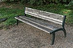
- backrest=yes/no – Whether the bench has a backrest (or backrests). This provides useful information for people with restricted mobility. People can use backrests to support them as they use the bench and also to help them to get on and off the bench.
- armrest=yes/no – Whether the bench has armrests. This provides useful information for people with restricted mobility. People can use armrests to help them get on and off the bench.
- seats=* – An estimate of the number of people that can comfortably sit on the bench.
- material=* – What the bench's seating is made from? e.g. wood, metal, concrete...
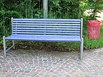
- colour=* – The main colour of the bench (the paint colour if it is painted, or the colour of the underlying material)
- direction=* – The direction that the bench (or a person sitting on it) faces. Use a compass point (e.g. "NW") or value in degrees (e.g. "315"). Can be used on benches mapped as nodes
 or lines
  .
. - side=left/right – For complex benches mapped as lines where direction=* is insufficient or confusing, side=* can be used to indicate where the bench faces, based on the line direction.
- two_sided=yes – Whether the bench can be sat on from both sides.
- length=* – The length of the bench.
- covered=yes – Whether the bench is covered.
- operator=* – The operator that is responsible for the bench.
- historic=memorial + memorial=bench - Used if the bench is a memorial.
- inscription=* – Any inscription or dedication on the bench. (Sometimes in connection with historic=memorial, memorial=bench or memorial=yes; or start date start_date=* information)
- openbenches:id=* – The entry ID of a memorial bench on Open Benches.
- bench:type=* – The type of the bench.
Examples
| Image | Tags |
|---|---|
|
|
|
|

|
|

|
|

|
Alternatively, this particular feature could be mapped as two adjacent bench nodes using direction=*. |
|
|

|
A node with natural=tree or man_made=planter.
For the bench: |

|
|
|
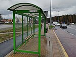
Note, this is a bus stop that incorporates a bench. |
Rendering
- nodes:

- ways: not rendered as of 8/2023. [1]
- nodes:
Wanderreitkarte – rendered in the online map
- JOSM – rendered with an icon of a backless bench, the special mappaint style Bench can be added
- Röntgen –
 , with backrest:
  , without backrest:
See also
- bench=yes/no – Used to indicate whether the feature has any benches or not
- memorial=bench – Specifies a memorial as a bench
- leisure=picnic_table – A table with benches for food and rest
- leisure=bleachers – Raised, tiered rows of benches found at spectator events
- leisure=outdoor seating - Where guests sit outside...
- amenity=lounger – An object for people to lie down
- playground=youth_bench – A special type of a bench, a playground facility with seating at different, age-appropriate seat heights
- Approved features/Bench – approved proposal for amenity=bench
- Proposed features/Public Transport#Platform – approved proposal for bench=yes/no
- Proposed features/Bench detail – originally rejected proposal for optional tags
External links
- MapContrib theme for benches and picnic tables – Simple online editor to add or edit benches.
