User:Sawan Shariar
Indroduction
S M Sawan Shariar (in bengali এস এম শাওন শাহরিয়ার) is a dedicated leader and advocate for open mapping initiatives, with a strong commitment to humanitarian efforts and community development. Currently serving as the President (Elected) at OpenStreetMap Bangladesh, Sawan brings a wealth of experience and expertise to the organization. As a Regional Ambassador at YouthMappers and a Voting Member at the Humanitarian OpenStreetMap Team (HOT), Sawan actively contributes to shaping the future of mapping technologies and their applications.
In addition to his leadership roles, Sawan is deeply involved in operational and coordination efforts as the Deputy Coordinator & Validation Lead at the Bangladesh Humanitarian OpenStreetMap Operational Team (BHOOT).
Sawan's contributions to the mapping community extend beyond his organizational roles. He has been recognized for his achievements, including being part of the winning team at the 2019 Global YouthMappers Challenge and serving as a Speakers Fellow at both the HOT Summit 2019 and the State of the Map 2019 conferences. Additionally, Sawan has played vital administrative roles, such as serving as an Administrative Assistant for the State of the Map Asia 2019 Organizing Committee and representing his country as a speaker at the State of the Map Asia 2018 event.
With his multifaceted involvement in mapping initiatives and humanitarian projects, Sawan Shariar continues to make significant contributions to advancing the use of open mapping for the betterment of communities worldwide.
His complete mapper profile can be found at: Sawan Shariar
- OSM Help
- OSM Forum
- OSM Wiki
- Missing Maps
- HOTOSM
- TeachOSM
- Mapillary
- Github
- Training Center
- OpenStreetView
- ODK
Projects
Map Your City ongoing project by BHOOT
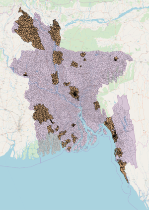
Map your city is a project initiated by BHOOT in collaboration with Pathao Ltd. to map down all the major cities in Bangladesh. It started long before the grant, but this grant gives a big push in the project as this help us to engage more volunteers with the project. Before the grant we only focused on completing Dhaka city, but after the device grant the project just got a shift and we completed most of the major cities in Bangladesh, such as Chittagong, Sylhet, Khulna, Rajshahi, Comilla, Jessore, Mymensingh, Narayanganj, Gazipur, Jamalpur. Currently, work is going on for other major cities like Savar. Eventually under the project the community will map down all the major cities of Bangladesh with all the roads connecting to them. This will establish a full country-wise connectivity.
Mapping Hydrological Features in Polder 43/2B
Bangladesh Open Innovation Lab (BOIL) is a technology and innovation consultant working in partnership with Deltares, a Netherlands based consultancy firm that working together with Bangladesh Government (GoB).
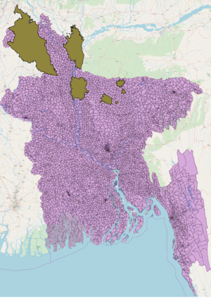
This work is a part of the Bangla Delta Plan 2100, a hundred years water management and development mechanism being implement by Government of Bangladesh (GoB). Initially the project aims to map out all the hydrological features in the polder 43/2B at Patuakhali District of Southern Bangladesh as a part of Water Management Knowledge and Innovation Program (WMKIP)
Mapping out Publicly Accessible Toilets at Dhaka City
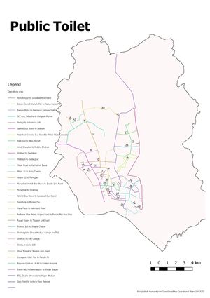
This project is outlined to collect all Publicly Accessible Toilet data at Dhaka City from the field and complement the database of the online platform PublicToiletBD powered by WaterAid. All field level data collection, QC and Upload will be done By Bangladesh Open Innovation Lab (BOIL)
South Asian Flood
Last year in July- August many south Asian countries were affected by a sudden flood. Among the southern countries, the low-lying countries like Bangladesh were the worst sufferers. To deal with the devastating after effect and also to set up a defense mechanism to the harshly affected areas the Red Cross and other international NGOs started working. HOT initiated an activation straightaway named “South Asian Flood Activation” to support the AID agencies. Led by BHOOT the OSMBD community responded to the situation and with the help of the grant devices the team started mapping the residential areas and major connecting roads of that affected areas. It is also an ongoing project to map the households and relating roads of the affected areas which will help to build a baseline map of the area and ensure effective response mechanism for any critical situation in the coming monsoon.
Clean Dhaka, Smart Dhaka: Identifying the Opportunities to Make Local Urban Waste Management More Sustainable and Resilient Using OpenStreetMap Data
Being one of the most densely populated cities, Dhaka faces a tremendous challenge in terms of waste management. Initially several initiatives have been taken to manage waste in a more coordinated way but first of all most of the organizations lack in proper geo-location of the waste related sites. So, the primary target of the project is to create a geodatabase waste disposal points of every size. This is more of a research project initially with the possible solution implementation advocacy & activism phase Upcoming. This project is initiated by BOIL (Bangladesh Open Innovation Lab), the mother concern of BHOOT.
Korail Slum Mapping in Dhaka city for NIHR Health Survey in Collaboration with University of Warwick, UK
Dhaka is one of the most densely populated cities in the world. As a result, the health situation is a major concern. This situation gets worse when it comes to the slums where thousands of people live in cluster of houses in a very small area. Because of the poor living condition, drainage system, inadequate ventilation etc. these slums are the potential areas for different diseases and therefore require proper medical interventions to save the people living here.
To understand the situation better, NIHR and Warwick University are jointly facilitating a research in the slums of 4 countries. The purpose of the research is to identify the location and details of medical facilities in the slums. In Bangladesh, Korail slum is home to around one lakh people who are living in a very small area of 9 acres. BHOOT is supporting the project with initial mapping and Structure verification.
Data for Action
Bangladesh Red Crescent Society along with American Red Cross; have taken an initiative to put vulnerable places in Dhaka into a map. The project was titled as Data4Action. The project mapping was supported by Open Street Map Bangladesh Community. Main goal of this project is to map different every buildings in the vulnerable area with an android application which has been developed by American Red Cross GIS team. Initial survey areas as selected are Gandaria and Moghbazar. Mapping of every building at Gandaria has already been done with Bangladesh Red Crescent Society volunteers. Outcome of the initial project work is really fruitfu
Blog/Dairy
YouthMappers

