File:20150823 000-jazheng.png
Jump to navigation
Jump to search

Size of this preview: 800 × 416 pixels. Other resolutions: 320 × 166 pixels | 640 × 333 pixels | 1,024 × 532 pixels | 1,630 × 847 pixels.
Original file (1,630 × 847 pixels, file size: 495 KB, MIME type: image/png)
Summary
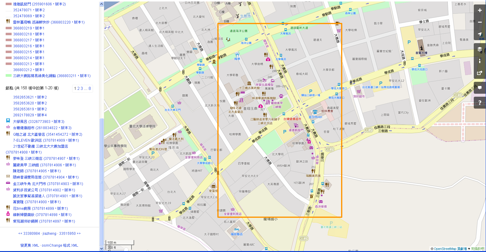
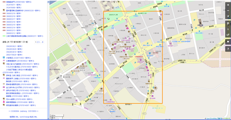
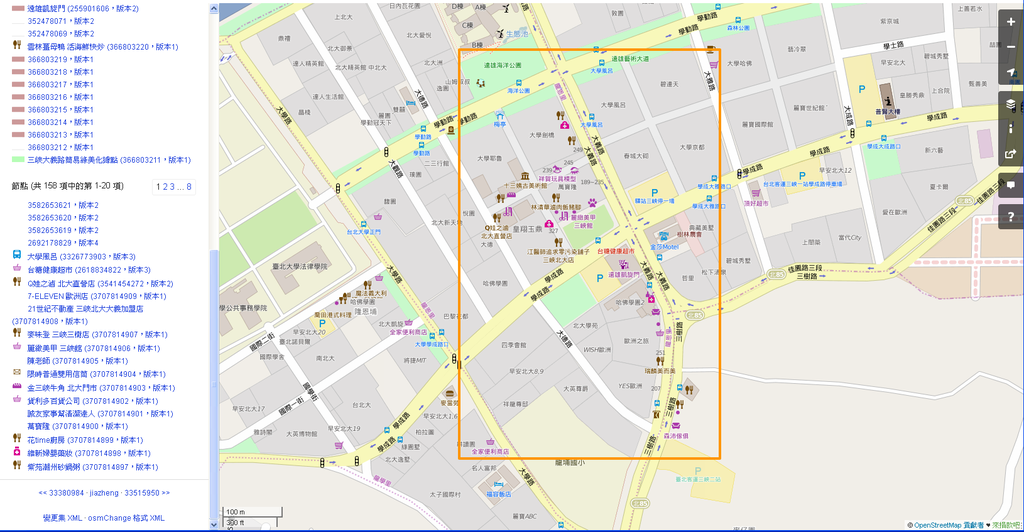
北大特區一帶圖客的努力 The map adding POI in Special Area Around National Taipei University.
Licensing
![]()
![]()
This screenshot contains OpenStreetMap Carto rendering.
The OpenStreetMap Carto map style is made available under the Creative Commons CC-0 1.0 Universal Public Domain Dedication.
- Attribution to the map data:
| Contains map data © OpenStreetMap contributors, made available under the terms of the Open Database License (ODbL).
The ODbL does not require any particular license for maps produced from ODbL data, produced maps may be subject also to other licences. |
File history
Click on a date/time to view the file as it appeared at that time.
| Date/Time | Thumbnail | Dimensions | User | Comment | |
|---|---|---|---|---|---|
| current | 04:55, 23 August 2015 | | 1,630 × 847 (495 KB) | Supaplex (talk | contribs) | 北大特區一帶圖客的努力 The map adding POI in Special Area Around National Taipei University. |
You cannot overwrite this file.
File usage
There are no pages that use this file.