File:AbingdonCake.png
Jump to navigation
Jump to search

Size of this preview: 604 × 599 pixels. Other resolutions: 242 × 240 pixels | 484 × 480 pixels | 646 × 641 pixels.
Original file (646 × 641 pixels, file size: 59 KB, MIME type: image/png)
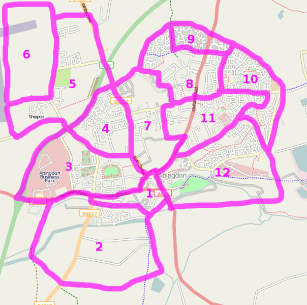
Composite cake diagram as it evolved during the morning and afternoon sessions. The numbers probably differ from the slices made on the day, and I've included slices for Shippon and Dalton Barracks for later discussions about completeness.
Licensing
![]()
![]()
![]()
This screenshot contains OpenStreetMap Carto rendering.
The OpenStreetMap Carto map style is made available under the Creative Commons CC-0 1.0 Universal Public Domain Dedication.
- Attribution to the map data:
![]()
Contains map data © OpenStreetMap contributors, made available under the terms of the Creative Commons Attribution-ShareAlike 2.0 (CC-BY-SA-2.0).
File history
Click on a date/time to view the file as it appeared at that time.
| Date/Time | Thumbnail | Dimensions | User | Comment | |
|---|---|---|---|---|---|
| current | 21:30, 27 October 2008 | | 646 × 641 (59 KB) | Achadwick (talk | contribs) | Composite cake diagram as it evolved during the morning and afternoon sessions. The numbers probably differ from the slices made on the day, and I've included slices for Shippon and Dalton Barracks for later discussions about completeness. |
You cannot overwrite this file.
File usage
The following page uses this file: