File:Area affected by landuse imports.png
Jump to navigation
Jump to search

Size of this preview: 629 × 599 pixels. Other resolutions: 252 × 240 pixels | 504 × 480 pixels | 737 × 702 pixels.
Original file (737 × 702 pixels, file size: 1.04 MB, MIME type: image/png)
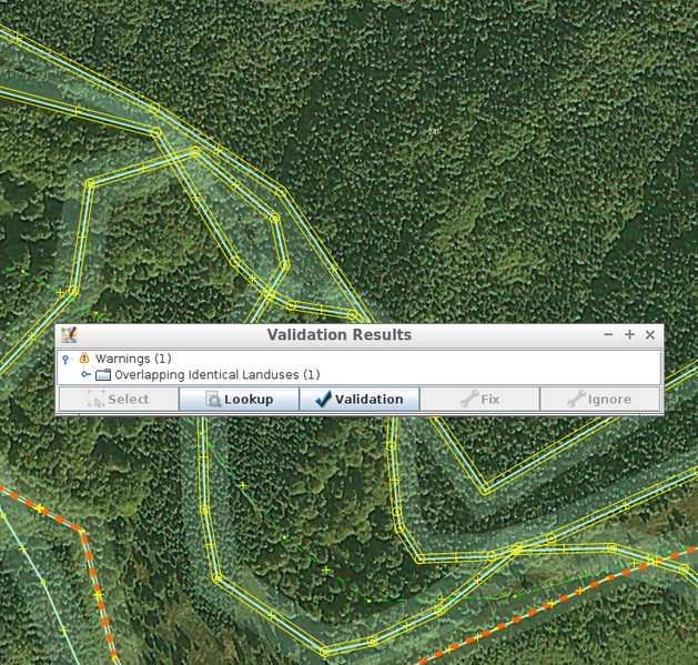
https://www.openstreetmap.org/#map=18/49.39878/18.98062 region, as of 2017-10-14
Area with overlapping forest areas created by landuse imports.
File history
Click on a date/time to view the file as it appeared at that time.
| Date/Time | Thumbnail | Dimensions | User | Comment | |
|---|---|---|---|---|---|
| current | 19:58, 15 October 2017 | | 737 × 702 (1.04 MB) | Mateusz Konieczny (talk | contribs) | https://www.openstreetmap.org/#map=18/49.39878/18.98062 region, as of 2017-10-14 Area with overlapping forest areas created by landuse imports. |
You cannot overwrite this file.
File usage
There are no pages that use this file.