File:Barrier and waypoint-EN.svg
Jump to navigation
Jump to search

Size of this PNG preview of this SVG file: 270 × 270 pixels. Other resolutions: 240 × 240 pixels | 480 × 480 pixels | 768 × 768 pixels | 1,024 × 1,024 pixels.
Original file (SVG file, nominally 270 × 270 pixels, file size: 23 KB)
Summary
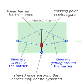
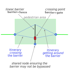
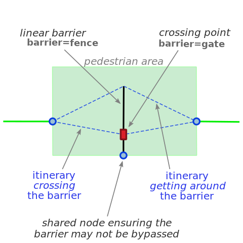
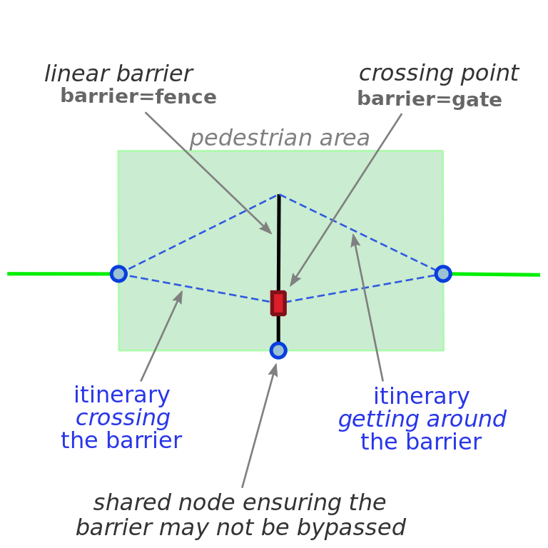
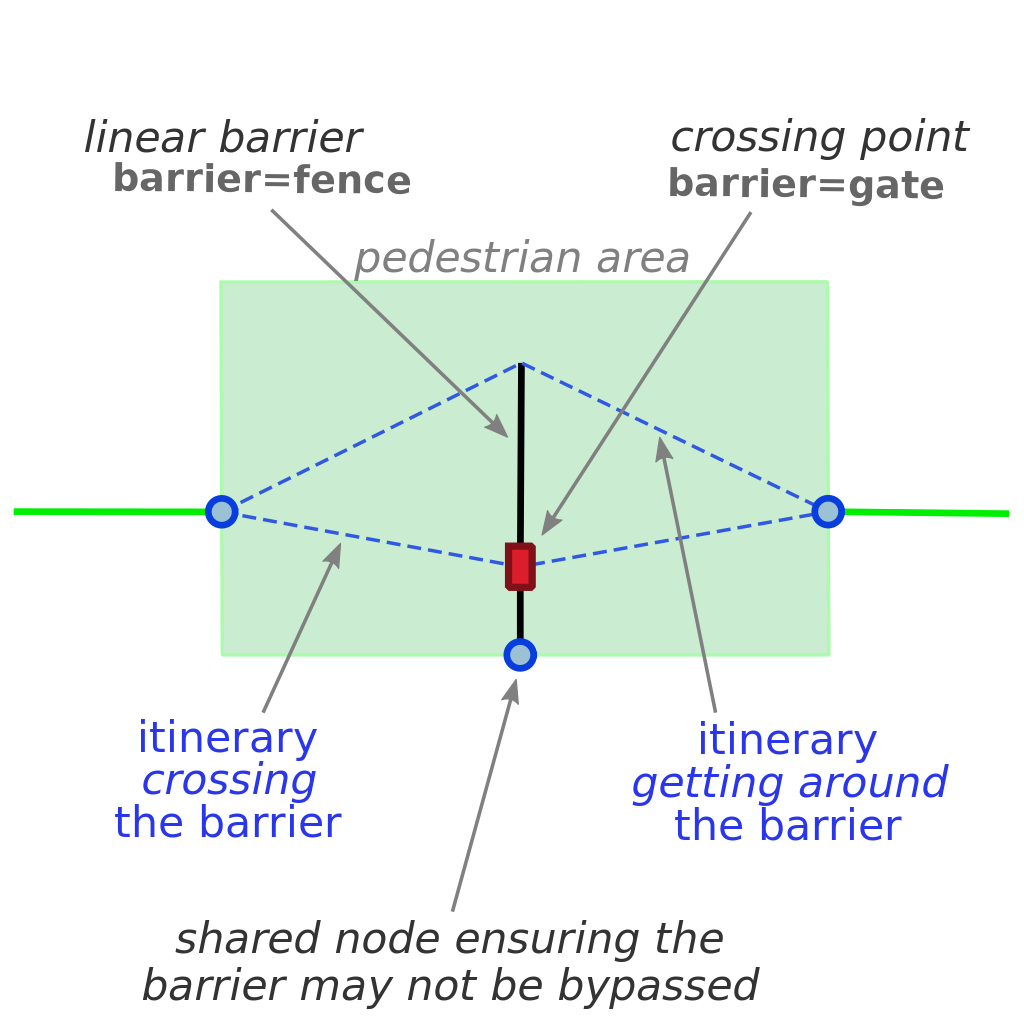
Pedestrian area routing – a linear barrier that can be got around or crossed through a waypoint.
Other versions
Version in Spanish

Licensing
- This media file was uploaded by author of the work and its copyright holder.
![]()
![]()
![]()
This work is licensed under the Creative Commons Attribution-ShareAlike 4.0 License.
Attribution: Carto'Cité
Attribution: Carto'Cité
File history
Click on a date/time to view the file as it appeared at that time.
| Date/Time | Thumbnail | Dimensions | User | Comment | |
|---|---|---|---|---|---|
| current | 15:25, 6 September 2019 | | 270 × 270 (23 KB) | Carto'Cité (talk | contribs) | Pedestrian area routing – a linear barrier that can be got around or crossed through a waypoint. |
You cannot overwrite this file.
File usage
The following page uses this file: