File:Bembridge coast.png
Jump to navigation
Jump to search

Size of this preview: 485 × 599 pixels. Other resolutions: 194 × 240 pixels | 389 × 480 pixels | 706 × 872 pixels.
Original file (706 × 872 pixels, file size: 17 KB, MIME type: image/png)
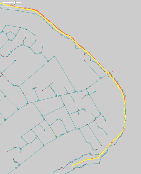
comparison of one kilometer of coastline in Bembridge with PGS data
File history
Click on a date/time to view the file as it appeared at that time.
| Date/Time | Thumbnail | Dimensions | User | Comment | |
|---|---|---|---|---|---|
| current | 14:19, 17 August 2006 | | 706 × 872 (17 KB) | Dmgroom (talk | contribs) | comparison of one kilometer of coastline in Bembridge with PGS data |
You cannot overwrite this file.
File usage
The following 2 pages use this file: