File:Bengaluru BMTC bus network rural coverage.png
Jump to navigation
Jump to search

Size of this preview: 754 × 600 pixels. Other resolutions: 302 × 240 pixels | 604 × 480 pixels | 966 × 768 pixels | 1,280 × 1,018 pixels | 1,524 × 1,212 pixels.
Original file (1,524 × 1,212 pixels, file size: 1.34 MB, MIME type: image/png)
Summary
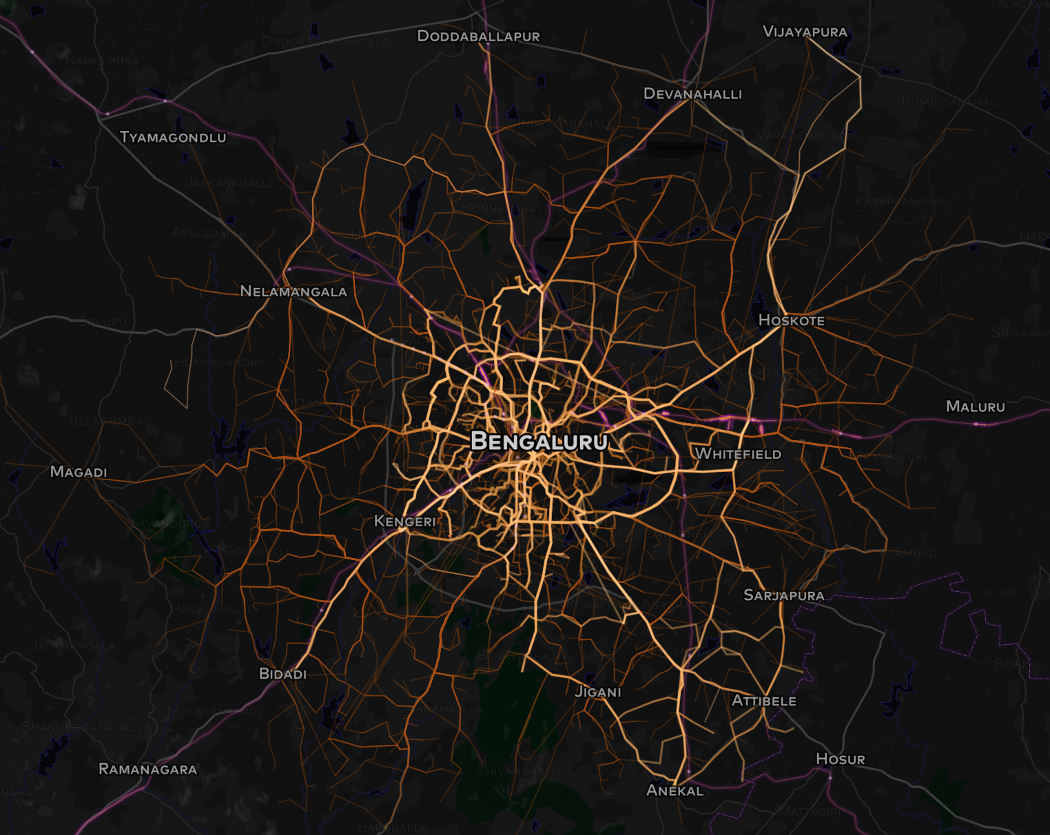
Open bus route data from the Bengaluru BMTC overlaid on an OSM base map showing the network connectivity with neighbouring towns.
Licensing
| Contains map data © OpenStreetMap contributors, made available under the terms of the Open Database License (ODbL).
The ODbL does not require any particular license for maps produced from ODbL data, produced maps may be subject also to other licences. |
File history
Click on a date/time to view the file as it appeared at that time.
| Date/Time | Thumbnail | Dimensions | User | Comment | |
|---|---|---|---|---|---|
| current | 18:45, 27 January 2016 | | 1,524 × 1,212 (1.34 MB) | Planemad (talk | contribs) | Open bus route data from the Bengaluru BMTC overlaid on an OSM base map showing the network connectivity with neighbouring towns. |
You cannot overwrite this file.
File usage
There are no pages that use this file.