File:Closer Midlands Area - JOSM.png
Jump to navigation
Jump to search


Size of this preview: 800 × 565 pixels. Other resolutions: 320 × 226 pixels | 640 × 452 pixels | 1,024 × 723 pixels | 1,174 × 829 pixels.
Original file (1,174 × 829 pixels, file size: 89 KB, MIME type: image/png)
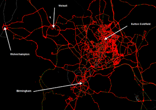
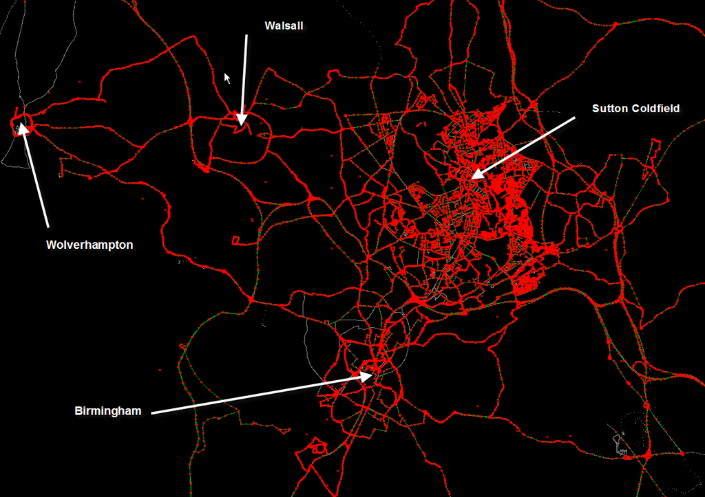
Annotated image snagged from Imi's JOSM detailing the gpx tracks, nodes and line segments in the Birmingham area of the UK.
Licensing
![]()
Contains map data © OpenStreetMap contributors, made available under the terms of the Creative Commons Attribution-ShareAlike 2.0 (CC-BY-SA-2.0).
File history
Click on a date/time to view the file as it appeared at that time.
| Date/Time | Thumbnail | Dimensions | User | Comment | |
|---|---|---|---|---|---|
| current | 11:55, 12 January 2006 | | 1,174 × 829 (89 KB) | Blackadder (talk | contribs) | Annotated image snagged from Imi's JOSM detailing the gpx tracks, nodes and line segments in the Birmingham area of the UK. |
You cannot overwrite this file.
File usage
The following page uses this file: