File:Comparison of OSGB projection parameters.png
Jump to navigation
Jump to search


Size of this preview: 800 × 450 pixels. Other resolutions: 320 × 180 pixels | 640 × 360 pixels | 1,024 × 576 pixels | 1,280 × 720 pixels | 1,920 × 1,080 pixels.
Original file (1,920 × 1,080 pixels, file size: 487 KB, MIME type: image/png)
Summary
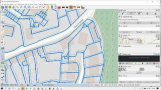
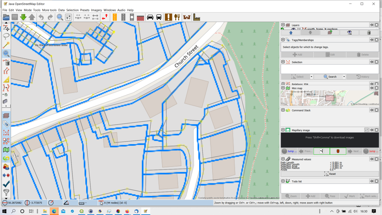
INSPIRE Property parcels are shown from the "UK Cadastral Parcels" TMS layer (transformed using the detailed correction factors from EPSG:27700 to WGS) and the same data read directly into JOSM using the base proj4 transformation. Area is in Kingsbridge, South Hams, Devon.
Licensing
![]()
![]()
![]()
This work is licensed under the Creative Commons Attribution-ShareAlike 4.0 License.
Attribution not specified as a parameter! THIS LICENSE ALWAYS REQUIRES ATTRIBUTION! Use {{CC-BY-SA-4.0|Attribution, typically name of author}} See Template:CC-BY-SA-4.0 for full description this template should be used.
Attribution not specified as a parameter! THIS LICENSE ALWAYS REQUIRES ATTRIBUTION! Use {{CC-BY-SA-4.0|Attribution, typically name of author}} See Template:CC-BY-SA-4.0 for full description this template should be used.
File history
Click on a date/time to view the file as it appeared at that time.
| Date/Time | Thumbnail | Dimensions | User | Comment | |
|---|---|---|---|---|---|
| current | 16:36, 3 March 2021 | | 1,920 × 1,080 (487 KB) | SK53 (talk | contribs) | INSPIRE Property parcels are shown from the "UK Cadastral Parcels" TMS layer (transformed using the detailed correction factors from EPSG:27700 to WGS) and the same data read directly into JOSM using the base proj4 transformation. Area is in Kingsbridge, South Hams, Devon. |
You cannot overwrite this file.
File usage
The following page uses this file: