File:Dop sotm.gif
Jump to navigation
Jump to search

Size of this preview: 800 × 378 pixels. Other resolutions: 320 × 151 pixels | 993 × 469 pixels.
Original file (993 × 469 pixels, file size: 25 KB, MIME type: image/gif)
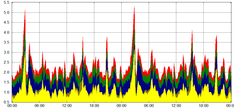
The DOP for the SOTM at Limerick. As calculated with an almanch from 15.04.08. DOP is the "geometric strength of satellite configuration on GPS accuracy"(wikipedia) lower values means better satelite positions = possibility of better data.
File history
Click on a date/time to view the file as it appeared at that time.
| Date/Time | Thumbnail | Dimensions | User | Comment | |
|---|---|---|---|---|---|
| current | 18:55, 15 April 2008 | | 993 × 469 (25 KB) | Moffi (talk | contribs) | The DOP for the SOTM at Limerick. As calculated with an almanch from 15.04.08. DOP is the "geometric strength of satellite configuration on GPS accuracy"(wikipedia) lower values means better satelite positions = possibility of better data. |
You cannot overwrite this file.
File usage
The following page uses this file: