File:Dual-carriageway-split.jpg
Jump to navigation
Jump to search

Size of this preview: 800 × 579 pixels. Other resolutions: 320 × 231 pixels | 640 × 463 pixels | 1,024 × 741 pixels | 1,149 × 831 pixels.
Original file (1,149 × 831 pixels, file size: 248 KB, MIME type: image/jpeg)
Summary
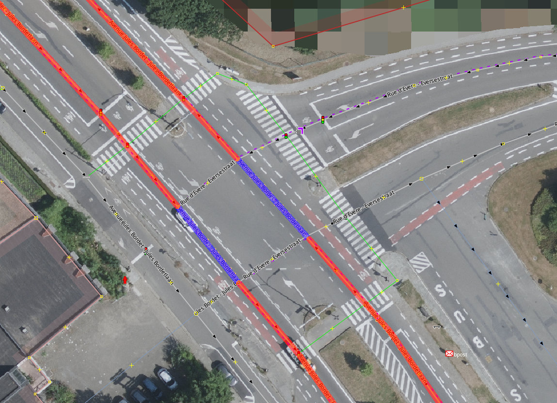
| Description | Ways in OSM near a complicated intersection |
|---|---|
| Author | bxl-forever |
| Source | Background image: UrbIS aerial imagery, provided by CIRB/CIBG} |
| Date | 2023-12-20 |
Licensing
![]()
![]()
This work is licensed under the Creative Commons Attribution 2.0 License.
Attribution: Background image: UrbIS aerial imagery, provided by CIRB/CIBG
Attribution: Background image: UrbIS aerial imagery, provided by CIRB/CIBG
The background image is taken from UrbIS aerial imagery, provided by CIRB/CIBG, from Brussels, Belgium. They publish aerial imagery using their own licence named Urbis Open Data Licence and the licence explicitely states that it is compatible with CC-BY 2.0 and with Open Data Commons Attribution License (ODC-By).
Drawing and adding OSM tags on top of the picture is personal work (bxl-forever): CC0 (Public Domain Dedication) for that part.
File history
Click on a date/time to view the file as it appeared at that time.
| Date/Time | Thumbnail | Dimensions | User | Comment | |
|---|---|---|---|---|---|
| current | 22:10, 20 December 2023 | | 1,149 × 831 (248 KB) | Bxl-forever (talk | contribs) | {{Information | description=Ways in OSM near a complicated intersection | source=Background image: UrbIS aerial imagery, provided by [https://cirb.brussels/ CIRB/CIBG]} | date=2023-12-20 | author=bxl-forever | other_versions= }} |
You cannot overwrite this file.
File usage
The following page uses this file: