File:Eine Insel für die Zeit.png
Jump to navigation
Jump to search

No higher resolution available.
Eine_Insel_für_die_Zeit.png (512 × 512 pixels, file size: 71 KB, MIME type: image/png)
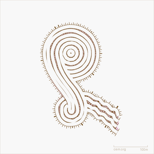
Eine Insel für die Zeit
Is a 1995 built geoglyph near Munich, Germany.
Image Details
Rendered with Osmarender z17, tagging of the ways is natural=cliff and embankment=yes. Data collected by Singvogel.
![]()
Contains map data © OpenStreetMap contributors, made available under the terms of the Creative Commons Attribution-ShareAlike 2.0 (CC-BY-SA-2.0).
File history
Click on a date/time to view the file as it appeared at that time.
| Date/Time | Thumbnail | Dimensions | User | Comment | |
|---|---|---|---|---|---|
| current | 01:30, 3 October 2010 | | 512 × 512 (71 KB) | Bass (talk | contribs) | |
| 00:57, 3 October 2010 | 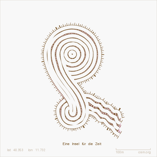 | 512 × 512 (73 KB) | Bass (talk | contribs) | ||
| 00:07, 3 October 2010 | 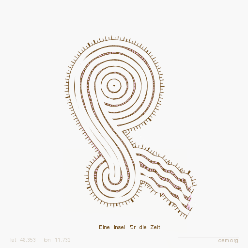 | 512 × 512 (77 KB) | Bass (talk | contribs) | Osmarender rendering |
You cannot overwrite this file.
File usage
The following page uses this file: