File:El Ferdan Railway Bridge.jpg
Jump to navigation
Jump to search


Size of this preview: 800 × 429 pixels. Other resolutions: 320 × 172 pixels | 640 × 343 pixels | 1,024 × 549 pixels | 1,280 × 687 pixels | 2,222 × 1,192 pixels.
Original file (2,222 × 1,192 pixels, file size: 283 KB, MIME type: image/jpeg)
This file and its description are from Wikimedia Commons.
Summary
| Description |
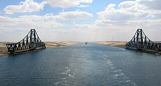
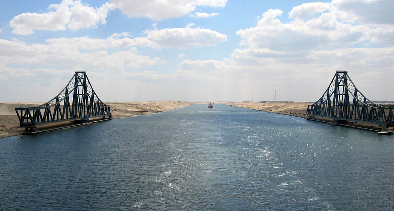
English: El Ferdan Railway Bridge, the longest swing bridge in the world, runs from the west of Suez Canal to the east into Sinai, opens most of the time to allow sailing ships to pass in the canal, and closes during passage of trains.
Deutsch: Die El-Ferdan-Brücke ist die längste Drehbrücke der Welt. Sie verbindet das Westufer des Suezkanals mit dem Sinai |
| Date | |
| Source | Own work |
| Author | H Nawara |
| Object location | | View this and other nearby images on: OpenStreetMap |
|---|
Licensing
| I, the copyright holder of this work, release this work into the public domain. This applies worldwide. In some countries this may not be legally possible; if so: I grant anyone the right to use this work for any purpose, without any conditions, unless such conditions are required by law. |
File history
Click on a date/time to view the file as it appeared at that time.
| Date/Time | Thumbnail | Dimensions | User | Comment | |
|---|---|---|---|---|---|
| current | 15:43, 2 September 2017 | | 2,222 × 1,192 (283 KB) | wikimediacommons>Zeugma fr | Rot 2.1° (horizon line); crop to 16/9 (remove overhead sky and water); auto contrast |
File usage
The following page uses this file: