File:Expressway or Not.png
Jump to navigation
Jump to search

Size of this preview: 800 × 600 pixels. Other resolutions: 320 × 240 pixels | 640 × 480 pixels | 960 × 720 pixels.
Original file (960 × 720 pixels, file size: 67 KB, MIME type: image/png)
Summary
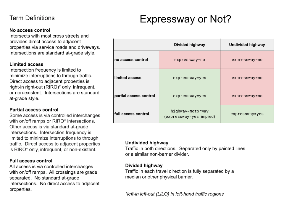
| Description | A chart for deciding if the tag expressway=yes is appropriate for a road or not |
|---|---|
| Author | |
| Source | https://docs.google.com/drawings/d/1O4mZbsYhL2xeHkUVaQiuONZQsj0K0gNg7-zbsQU5XzM/edit?usp=sharing |
Licensing
- This media file was uploaded by author of the work and its copyright holder.
![]()
![]()
This file is made available under the Creative Commons CC0 1.0 Universal Public Domain Dedication.
The person who associated a work with this deed has dedicated the work to the public domain by waiving all of his or her rights to the work worldwide under copyright law, including all related and neighboring rights, to the extent allowed by law. You can copy, modify, distribute and perform the work, even for commercial purposes, all without asking permission.
File history
Click on a date/time to view the file as it appeared at that time.
| Date/Time | Thumbnail | Dimensions | User | Comment | |
|---|---|---|---|---|---|
| current | 19:17, 3 September 2022 | | 960 × 720 (67 KB) | Ezekielf (talk | contribs) | rewrite sentences on direct access to adjacent properties to allow more flexibility |
| 17:37, 3 September 2022 | 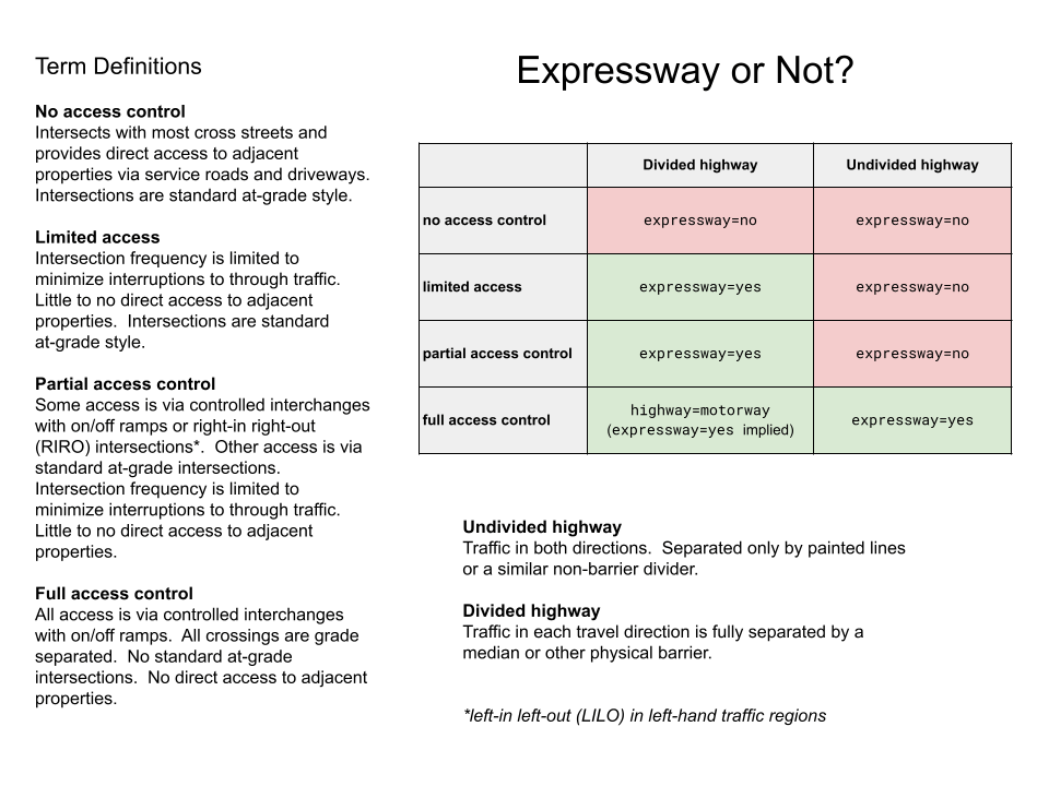 | 960 × 720 (65 KB) | Ezekielf (talk | contribs) | RIRO -> right-in right-out, plus note about LILO in left-hand traffic countries | |
| 14:24, 3 September 2022 | 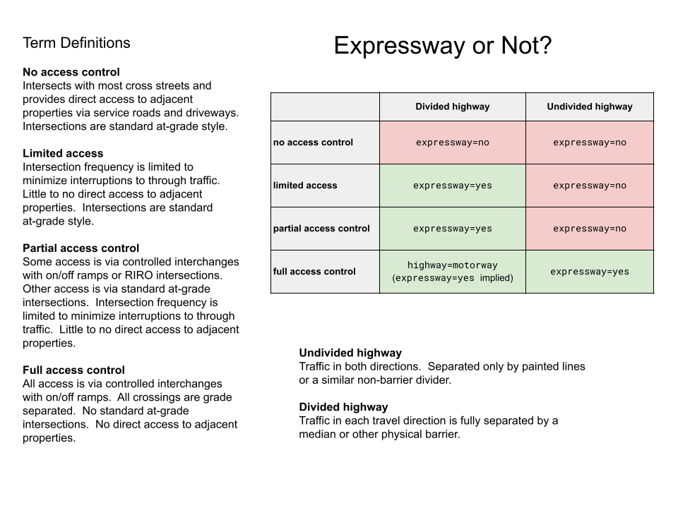 | 960 × 720 (135 KB) | Ezekielf (talk | contribs) | {{Information | description=A chart for helping decide if the tag expressway=yes is appropriate for a road or not | source=https://docs.google.com/drawings/d/1O4mZbsYhL2xeHkUVaQiuONZQsj0K0gNg7-zbsQU5XzM/edit?usp=sharing }} |
You cannot overwrite this file.
File usage
The following 3 pages use this file: