File:Gers Ulaanbaatar.png
Jump to navigation
Jump to search

Size of this preview: 800 × 494 pixels. Other resolutions: 320 × 198 pixels | 640 × 395 pixels | 1,177 × 727 pixels.
Original file (1,177 × 727 pixels, file size: 700 KB, MIME type: image/png)
Summary
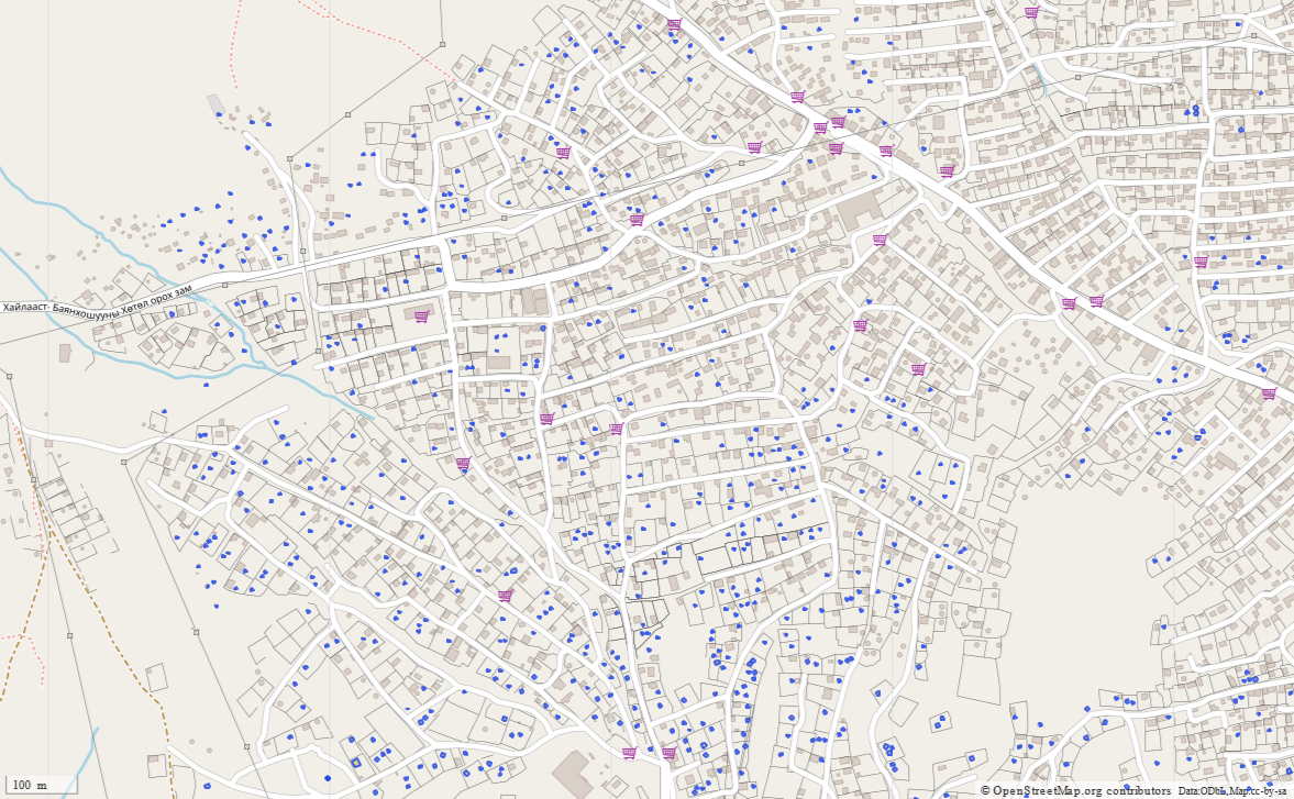
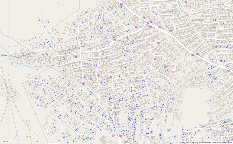
An area of Ulanbaatar queried in Overpass showing the density of gers in some outlying parts of the city. Query: https://overpass-turbo.eu/s/19FG
Licensing
| Contains map data © OpenStreetMap contributors, made available under the terms of the Open Database License (ODbL).
The ODbL does not require any particular license for maps produced from ODbL data, produced maps may be subject also to other licences. |
File history
Click on a date/time to view the file as it appeared at that time.
| Date/Time | Thumbnail | Dimensions | User | Comment | |
|---|---|---|---|---|---|
| current | 13:36, 23 July 2021 | | 1,177 × 727 (700 KB) | SK53 (talk | contribs) | An area of Ulanbaatar queried in Overpass showing the density of gers in some outlying parts of the city. Query: https://overpass-turbo.eu/s/19FG |
You cannot overwrite this file.
File usage
The following 3 pages use this file: