File:Kiltera Ogham Stone.jpg
Jump to navigation
Jump to search


Size of this preview: 800 × 600 pixels. Other resolutions: 320 × 240 pixels | 640 × 480 pixels | 1,024 × 768 pixels.
Original file (1,024 × 768 pixels, file size: 407 KB, MIME type: image/jpeg)
This file and its description are from Wikimedia Commons.
Summary
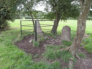
| Description | Kiltera Ogham Stone, Co Waterford, Ireland |
| Date | |
| Source | http://www.geograph.ie/photo/3090301 |
| Author | Hywel Williams |
| Permission (Reusing this file) |
Evidence: The license statement can be found online at: http://www.geograph.ie/photo/3090301 |
| Attribution (required by the license) | Hywel Williams / Kiltera Ogham Stone / |
| Camera location | | View this and other nearby images on: OpenStreetMap |
|---|
_heading:225.00&language=en)
| Object location | | View this and other nearby images on: OpenStreetMap |
|---|
_heading:225.00&language=en)
Licensing

|
This image was taken from the Geograph project collection. See this photograph's page on the Geograph website for the photographer's contact details. The copyright on this image is owned by Hywel Williams and is licensed for reuse under the Creative Commons Attribution-ShareAlike 2.0 license.
|
This file is licensed under the Creative Commons Attribution-Share Alike 2.0 Generic license.
Attribution: Hywel Williams
- You are free:
- to share – to copy, distribute and transmit the work
- to remix – to adapt the work
- Under the following conditions:
- attribution – You must give appropriate credit, provide a link to the license, and indicate if changes were made. You may do so in any reasonable manner, but not in any way that suggests the licensor endorses you or your use.
- share alike – If you remix, transform, or build upon the material, you must distribute your contributions under the same or compatible license as the original.
Original upload log
The original description page was here. All following user names refer to en.wikipedia.
| Date/Time | Dimensions | User | Comment |
|---|---|---|---|
| 2017-01-11 22:36:59 | 640× 480× | Debbiesw | Uploading a free file from somebody else using [[Wikipedia:File_Upload_Wizard|File Upload Wizard]] |
File history
Click on a date/time to view the file as it appeared at that time.
| Date/Time | Thumbnail | Dimensions | User | Comment | |
|---|---|---|---|---|---|
| current | 18:35, 3 February 2018 | | 1,024 × 768 (407 KB) | wikimediacommons>Geograph Update Bot | Higher-resolution version from Geograph. |
File usage
The following page uses this file: