File:LA2-tah-404.png
Jump to navigation
Jump to search

Size of this preview: 800 × 549 pixels. Other resolutions: 320 × 220 pixels | 640 × 439 pixels | 979 × 672 pixels.
Original file (979 × 672 pixels, file size: 66 KB, MIME type: image/png)
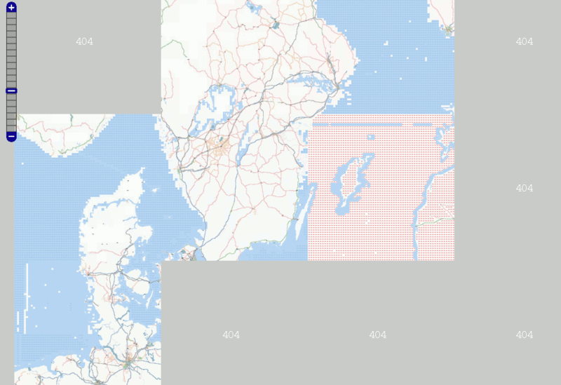
Screenshot showing the Osmarender layer from tiles@home on May 21, 2007, including "blue dots" (404 at sea), "red dots" (Database unavailable) and large grey 404 tiles for areas that have not been rendered since the new disk (hdd1) was installed for t@h in the "dev" server.
![]()
Contains map data © OpenStreetMap contributors, made available under the terms of the Creative Commons Attribution-ShareAlike 2.0 (CC-BY-SA-2.0).
File history
Click on a date/time to view the file as it appeared at that time.
| Date/Time | Thumbnail | Dimensions | User | Comment | |
|---|---|---|---|---|---|
| current | 11:41, 21 May 2007 | | 979 × 672 (66 KB) | LA2 (talk | contribs) | Screenshot showing the Osmarender layer from tiles@home on May 21, 2007, including "blue dots" (404 at sea), "red dots" (Database unavailable) and large grey 404 tiles for areas that have not been rendered since the new disk (hdd1) was installed for t |
You cannot overwrite this file.
File usage
The following page uses this file: