File:LakeOntarioInProgress.png
Jump to navigation
Jump to search


Size of this preview: 800 × 413 pixels. Other resolutions: 320 × 165 pixels | 834 × 431 pixels.
Original file (834 × 431 pixels, file size: 14 KB, MIME type: image/png)
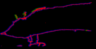
Upload of Lake Ontario coastline in progress. Some surrounding water features are also included (see southwest area). Some osm activity in surrounding areas also visible. Upload is using Almien's coastlines scripts and PGS data source.
File history
Click on a date/time to view the file as it appeared at that time.
| Date/Time | Thumbnail | Dimensions | User | Comment | |
|---|---|---|---|---|---|
| current | 12:34, 19 October 2006 | | 834 × 431 (14 KB) | Rw (talk | contribs) | Upload of Lake Ontario coastline in progress. Some surrounding water features are also included (see southwest area). Some osm activity in surrounding areas also visible. Upload is using Almien's coastlines scripts and PGS data source. |
You cannot overwrite this file.
File usage
The following page uses this file: