File:Mandela Subward in Tabata Ward flood response.png
Jump to navigation
Jump to search

Size of this preview: 800 × 564 pixels. Other resolutions: 320 × 226 pixels | 640 × 451 pixels | 1,024 × 722 pixels | 1,233 × 869 pixels.
Original file (1,233 × 869 pixels, file size: 961 KB, MIME type: image/png)
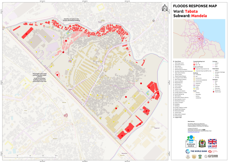
a visual of a flood response map
| Contains map data © OpenStreetMap contributors, made available under the terms of the Open Database License (ODbL).
The ODbL does not require any particular license for maps produced from ODbL data, produced maps may be subject also to other licences. |
![]()
![]()
![]()
This work is licensed under the Creative Commons Attribution-ShareAlike 4.0 License.
Attribution: Humanitarian OpenStreetMap Team
Attribution: Humanitarian OpenStreetMap Team
File history
Click on a date/time to view the file as it appeared at that time.
| Date/Time | Thumbnail | Dimensions | User | Comment | |
|---|---|---|---|---|---|
| current | 09:17, 9 October 2019 | | 1,233 × 869 (961 KB) | Immaculate Mwanja (talk | contribs) |
You cannot overwrite this file.
File usage
The following page uses this file: