File:Mapping-baseball-field-outfield.jpg
Jump to navigation
Jump to search

No higher resolution available.
Mapping-baseball-field-outfield.jpg (220 × 218 pixels, file size: 41 KB, MIME type: image/jpeg)
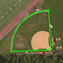
Image showing the correct plate to map a baseball field.
File history
Click on a date/time to view the file as it appeared at that time.
| Date/Time | Thumbnail | Dimensions | User | Comment | |
|---|---|---|---|---|---|
| current | 01:25, 19 December 2017 | | 220 × 218 (41 KB) | Jremillard (talk | contribs) |
You cannot overwrite this file.
File usage
The following page uses this file: