File:Maxar Premium North Korea track image (circa 2021).png
Jump to navigation
Jump to search

Size of this preview: 760 × 599 pixels. Other resolutions: 304 × 240 pixels | 609 × 480 pixels | 974 × 768 pixels | 1,037 × 818 pixels.
Original file (1,037 × 818 pixels, file size: 1.84 MB, MIME type: image/png)
Summary
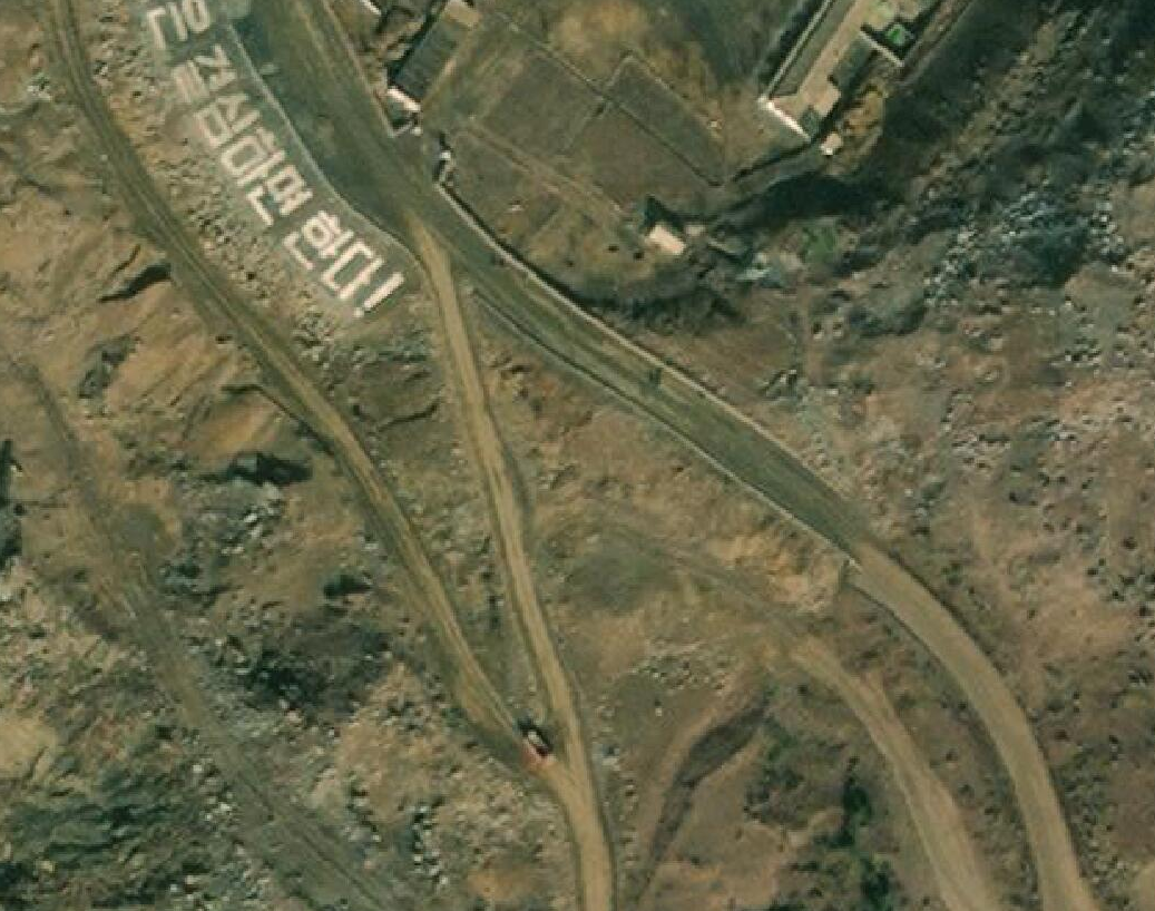
| Description | A Maxar satellite image of a track in North Korea, for usage in the North Korea Mapping Guide. | ||||||||||||||
|---|---|---|---|---|---|---|---|---|---|---|---|---|---|---|---|
| Author |
| ||||||||||||||
| Source | Maxar Premium Imagery layer | ||||||||||||||
| Date | ~2021 | ||||||||||||||
| Permission |
This image is composed entirely, or almost entirely, of Maxar aerial imagery.
Maxar imagery is not open licensed, but is generously made available to the OpenStreetMap project for deriving open licensed map data. This upload is not certain to covered by permission described at Maxar ("you may only use our imagery to trace, and validate edits that must be contributed back to OSM. You cannot download our imagery or use our imagery for any other purpose.".) Maybe this use can fit under "validate edits"? This image is a relatively minor extract of the (worldwide) Maxar imagery, used for illustrative purposes on the OpenStreetMap wiki, to help document ways of using and interpreting the imagery in the OpenStreetMap mapping process. | ||||||||||||||
File history
Click on a date/time to view the file as it appeared at that time.
| Date/Time | Thumbnail | Dimensions | User | Comment | |
|---|---|---|---|---|---|
| current | 17:50, 23 March 2022 | | 1,037 × 818 (1.84 MB) | Berrely (talk | contribs) | better |
| 17:49, 23 March 2022 |  | 684 × 589 (911 KB) | Berrely (talk | contribs) | {{Information |description = A Maxar satellite image of a track in North Korea, for usage in the North Korea Mapping Guide. |date = ~2021 |source = Maxar Premium Imagery layer |author = {{Maxar author}} |permission = {{Maxar image}} |other_versions = }} |
You cannot overwrite this file.
File usage
There are no pages that use this file.
.png&oldid=2296944)