File:Melbourne Inner OpenStreetMap April 24 2008 Mapnik Update.png
Jump to navigation
Jump to search

Size of this preview: 637 × 599 pixels. Other resolutions: 255 × 240 pixels | 510 × 480 pixels | 1,008 × 948 pixels.
Original file (1,008 × 948 pixels, file size: 423 KB, MIME type: image/png)
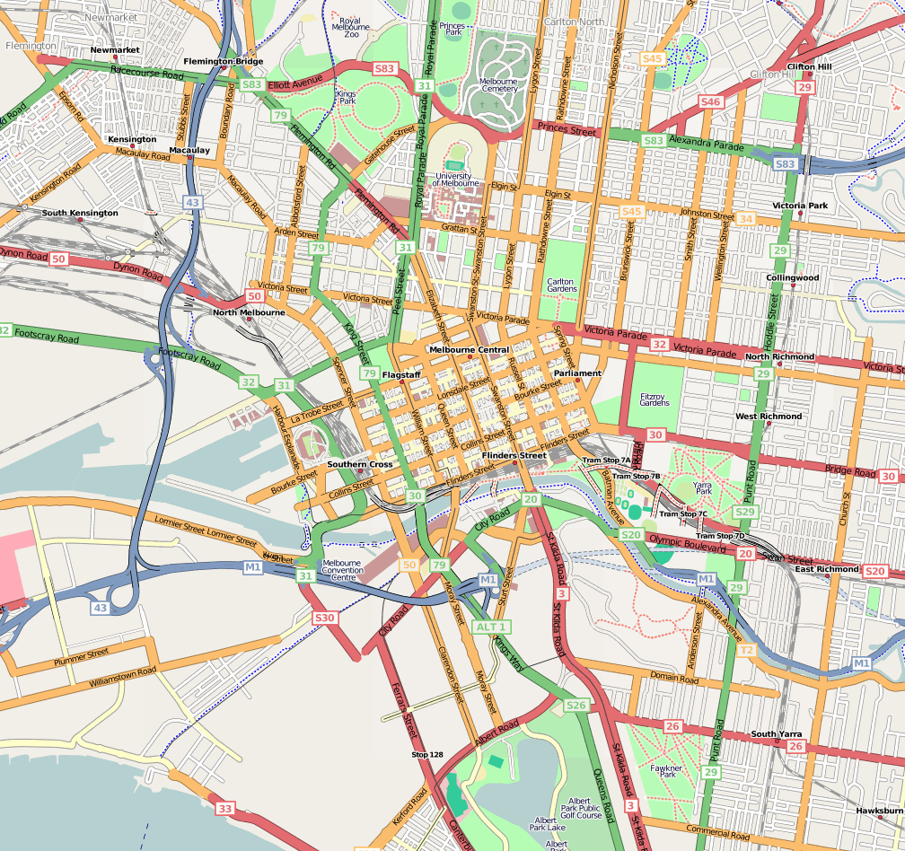
The area of inner Melbourne, Australia covered by OpenStreetMap on April 24, 2008 update.
![]()
Contains map data © OpenStreetMap contributors, made available under the terms of the Creative Commons Attribution-ShareAlike 2.0 (CC-BY-SA-2.0).
File history
Click on a date/time to view the file as it appeared at that time.
| Date/Time | Thumbnail | Dimensions | User | Comment | |
|---|---|---|---|---|---|
| current | 12:14, 24 April 2008 | | 1,008 × 948 (423 KB) | Lakeyboy (talk | contribs) | The area of inner Melbourne, Australia covered by ''OpenStreetMap'' on April 24, 2008 update. |
You cannot overwrite this file.
File usage
The following page uses this file: