File:Menhirs Carnac.png
Jump to navigation
Jump to search

Size of this preview: 566 × 599 pixels. Other resolutions: 227 × 240 pixels | 453 × 480 pixels | 726 × 768 pixels | 1,233 × 1,305 pixels.
Original file (1,233 × 1,305 pixels, file size: 1.35 MB, MIME type: image/png)
Summary
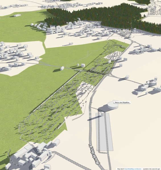
More than 2000 megaliths mapped in Carnac, France
3D rendering by F4 Map: map link (show location on OSM.org)
License
CC-By-NC (see F4_Map#Licensing) – unless you assume a own copyright by the screenshot producer (apparently user:Cquest) who chose the position, angle and zoom.
| Contains map data © OpenStreetMap contributors, made available under the terms of the Open Database License (ODbL).
The ODbL does not require any particular license for maps produced from ODbL data, produced maps may be subject also to other licences. |
File history
Click on a date/time to view the file as it appeared at that time.
| Date/Time | Thumbnail | Dimensions | User | Comment | |
|---|---|---|---|---|---|
| current | 07:58, 29 September 2013 | | 1,233 × 1,305 (1.35 MB) | Cquest (talk | contribs) | More than 2000 megaliths mapped in Carnac, France 3D rendering by F4 Map: http://map.f4-group.com/#lat=47.5926082&lon=-3.0816077&zoom=18&camera.theta=63.352&camera.phi=-47.841 |
You cannot overwrite this file.