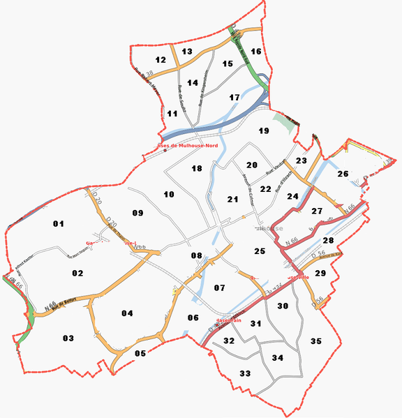
File:Mulhouse mapping zones.PNG
Jump to navigation
Jump to search

Size of this preview: 576 × 599 pixels. Other resolutions: 231 × 240 pixels | 461 × 480 pixels | 821 × 854 pixels.
Original file (821 × 854 pixels, file size: 239 KB, MIME type: image/png)
Mulhouse zoned for mapping parties or sharing work
File history
Click on a date/time to view the file as it appeared at that time.
| Date/Time | Thumbnail | Dimensions | User | Comment | |
|---|---|---|---|---|---|
| current | 19:08, 2 November 2008 | | 821 × 854 (239 KB) | Pieren (talk | contribs) | Mulhouse zoned for mapping parties or sharing work |
You cannot overwrite this file.
File usage
There are no pages that use this file.