File:Need for parcels Alameda County.png
Jump to navigation
Jump to search

Size of this preview: 800 × 485 pixels. Other resolutions: 320 × 194 pixels | 640 × 388 pixels | 974 × 591 pixels.
Original file (974 × 591 pixels, file size: 235 KB, MIME type: image/png)
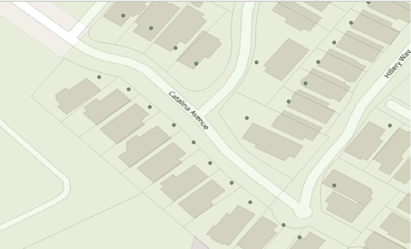
The picture illustrates the spatial match between OSM-buildings, parcels and imported address points
File history
Click on a date/time to view the file as it appeared at that time.
| Date/Time | Thumbnail | Dimensions | User | Comment | |
|---|---|---|---|---|---|
| current | 13:25, 17 September 2020 | | 974 × 591 (235 KB) | Yury Yatsynovich (talk | contribs) |
You cannot overwrite this file.
File usage
The following page uses this file: