File:Newlands.png
Jump to navigation
Jump to search

Size of this preview: 800 × 505 pixels. Other resolutions: 320 × 202 pixels | 640 × 404 pixels | 1,089 × 687 pixels.
Original file (1,089 × 687 pixels, file size: 442 KB, MIME type: image/png)
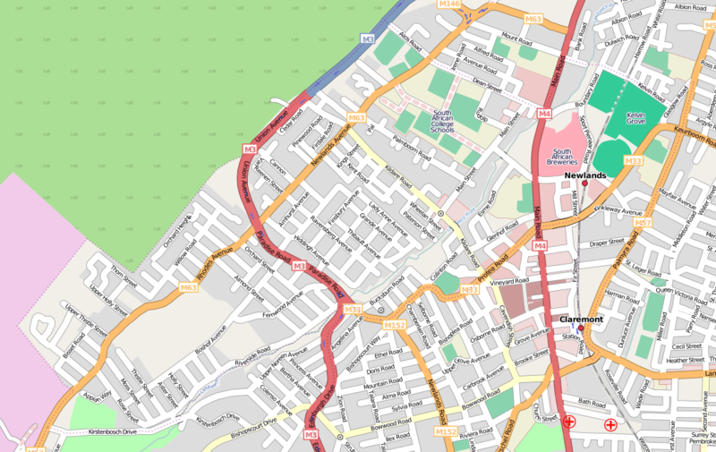
Map of Newlands, Cape Town.
Licensing
![]()
![]()
![]()
This screenshot contains OpenStreetMap Carto rendering.
The OpenStreetMap Carto map style is made available under the Creative Commons CC-0 1.0 Universal Public Domain Dedication.
- Attribution to the map data:
![]()
Contains map data © OpenStreetMap contributors, made available under the terms of the Creative Commons Attribution-ShareAlike 2.0 (CC-BY-SA-2.0).
File history
Click on a date/time to view the file as it appeared at that time.
| Date/Time | Thumbnail | Dimensions | User | Comment | |
|---|---|---|---|---|---|
| current | 16:01, 7 October 2008 | | 1,089 × 687 (442 KB) | Htonl (talk | contribs) | updated version |
| 11:24, 27 April 2008 |  | 828 × 544 (298 KB) | Htonl (talk | contribs) | Map of Newlands, Cape Town. |
You cannot overwrite this file.
File usage
The following 2 pages use this file: