File:OSM map for Ananthavaram at lower zoom to identify administration hierarchy info.png
Jump to navigation
Jump to search


Size of this preview: 800 × 455 pixels. Other resolutions: 320 × 182 pixels | 640 × 364 pixels | 1,024 × 583 pixels | 1,280 × 729 pixels | 1,850 × 1,053 pixels.
Original file (1,850 × 1,053 pixels, file size: 472 KB, MIME type: image/png)
This file and its description are from Wikimedia Commons.
Summary
| Description |
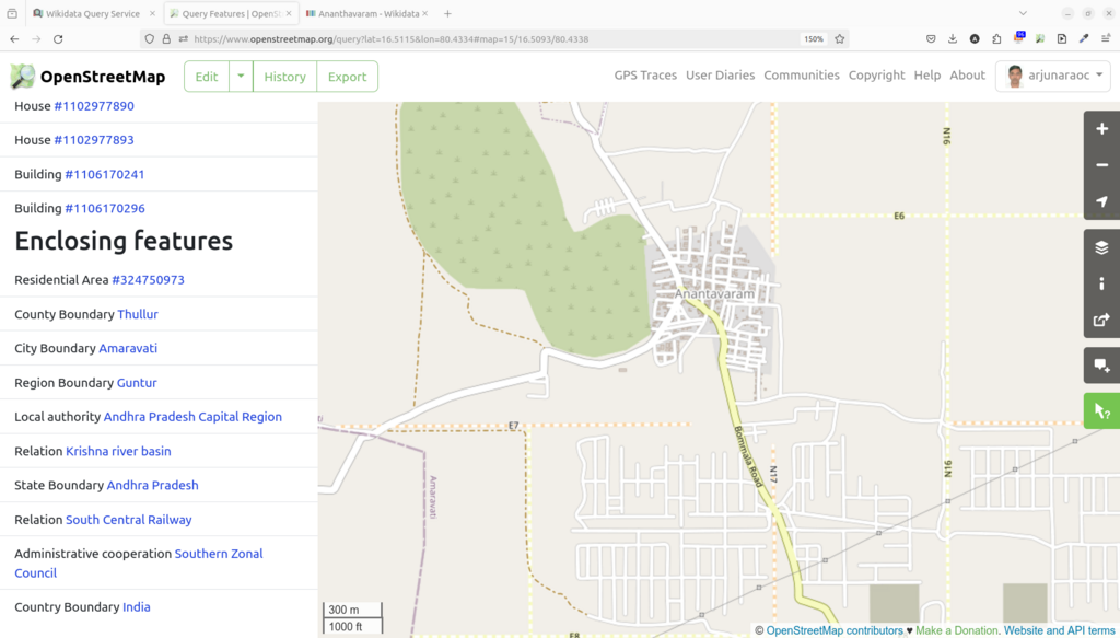
English: OSM map for Ananthavaram at lower zoom to identify administration hierarchy info such as county(mandal), region (district) info |
| Date | |
| Source | Own work |
| Author | Arjunaraoc |
Licensing
| This work contains information from OpenStreetMap, which is made available under the Open Database License (ODbL).
The ODbL does not require any particular license for maps produced from ODbL data. Prior to 1 August 2020, map tiles produced by the OpenStreetMap Foundation were licensed under the CC-BY-SA-2.0 license. Maps produced by other people may be subject to other licences. |
File history
Click on a date/time to view the file as it appeared at that time.
| Date/Time | Thumbnail | Dimensions | User | Comment | |
|---|---|---|---|---|---|
| current | 22:25, 9 April 2024 | | 1,850 × 1,053 (472 KB) | wikimediacommons>Arjunaraoc | Uploaded own work with UploadWizard |
File usage
The following page uses this file: