File:Obere Batterthuette 560n ue NN.jpg
Jump to navigation
Jump to search

Size of this preview: 800 × 592 pixels. Other resolutions: 320 × 237 pixels | 640 × 473 pixels | 856 × 633 pixels.
Original file (856 × 633 pixels, file size: 100 KB, MIME type: image/jpeg)
Summary
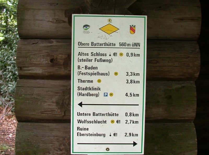
Schil an der Oberen Batterthütte mit Höhenangabe in Metern über Normal Null. Eigenes Werk
Licensing
![]()
This file has been released into the public domain by the copyright holder, its copyright has expired, or it is ineligible for copyright. This applies worldwide.
Please, please use more specific template such as {{PD-self}} / {{PD-creator}} / {{PD-shape}} / {{PD-USGov}} / {{PD-old}} / {{PD-RU-exempt}} ... This template is not making clear why this work is in the public domain.
Please, please use more specific template such as {{PD-self}} / {{PD-creator}} / {{PD-shape}} / {{PD-USGov}} / {{PD-old}} / {{PD-RU-exempt}} ... This template is not making clear why this work is in the public domain.
File history
Click on a date/time to view the file as it appeared at that time.
| Date/Time | Thumbnail | Dimensions | User | Comment | |
|---|---|---|---|---|---|
| current | 10:21, 29 April 2013 | | 856 × 633 (100 KB) | Oranger Assistent (talk | contribs) | Schil an der Oberen Batterthütte mit Höhenangabe in Metern über Normal Null. Eigenes Werk |
You cannot overwrite this file.
File usage
There are no pages that use this file.