File:Openstreetmap mapping streets with family on el hierro island.jpg
Jump to navigation
Jump to search


Size of this preview: 407 × 599 pixels. Other resolutions: 163 × 240 pixels | 326 × 480 pixels | 522 × 768 pixels | 696 × 1,024 pixels | 1,944 × 2,860 pixels.
Original file (1,944 × 2,860 pixels, file size: 1.2 MB, MIME type: image/jpeg)
This file and its description are from Wikimedia Commons.

|
The uploader asserts the following regarding consent of identifiable persons: I personally created this media. All identifiable persons shown specifically consented to publication of this photograph or video. |
Summary
| Description |
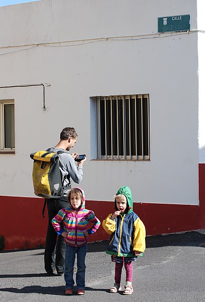
English: Mapping streets for Openstreetmap on a family getaway on El Hierro island. (Street sign identifies location as Calle Montaña Aguarijo, Valverde, El Hierro island, Santa Cruz province, Canary Islands, Spain.)
Deutsch: Straßen für Openstreetmap während eines Familienausflugs auf der Insel El Hierro kartieren. |
| Date | |
| Source | Own work |
| Author | Erik Streb |
| Camera location | | View this and other nearby images on: OpenStreetMap |
|---|
Licensing
I, the copyright holder of this work, hereby publish it under the following licenses:

|
Permission is granted to copy, distribute and/or modify this document under the terms of the GNU Free Documentation License, Version 1.2 or any later version published by the Free Software Foundation; with no Invariant Sections, no Front-Cover Texts, and no Back-Cover Texts. A copy of the license is included in the section entitled GNU Free Documentation License. |
This file is licensed under the Creative Commons Attribution-Share Alike 3.0 Unported license.
- You are free:
- to share – to copy, distribute and transmit the work
- to remix – to adapt the work
- Under the following conditions:
- attribution – You must give appropriate credit, provide a link to the license, and indicate if changes were made. You may do so in any reasonable manner, but not in any way that suggests the licensor endorses you or your use.
- share alike – If you remix, transform, or build upon the material, you must distribute your contributions under the same or compatible license as the original.
You may select the license of your choice.
File history
Click on a date/time to view the file as it appeared at that time.
| Date/Time | Thumbnail | Dimensions | User | Comment | |
|---|---|---|---|---|---|
| current | 18:09, 31 January 2012 | | 1,944 × 2,860 (1.2 MB) | wikimediacommons>Erik del Toro Streb | {{Information |Description ={{en|1=Mapping streets for Openstreetmap on a family getaway on El Hierro island.}} {{de|1=Straßen für Openstreetmap während eines Familienausflugs auf der Ins |
File usage
The following page uses this file: