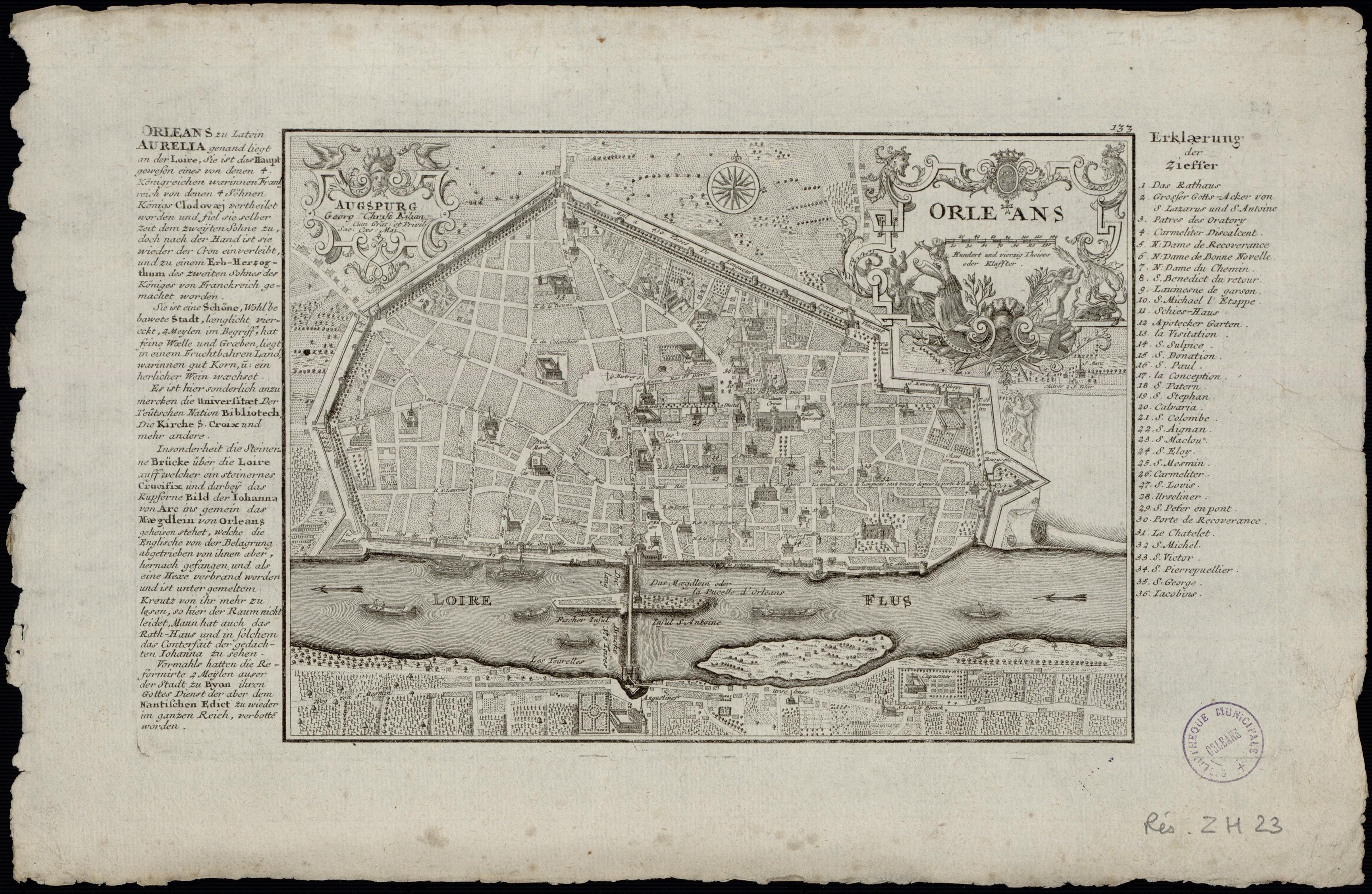
File:Orléans. Plan. 1723.jpg
Jump to navigation
Jump to search

Size of this preview: 800 × 521 pixels. Other resolutions: 320 × 209 pixels | 640 × 417 pixels | 1,024 × 667 pixels | 1,280 × 834 pixels | 2,560 × 1,668 pixels | 3,456 × 2,252 pixels.
Original file (3,456 × 2,252 pixels, file size: 1.41 MB, MIME type: image/jpeg)
Summary
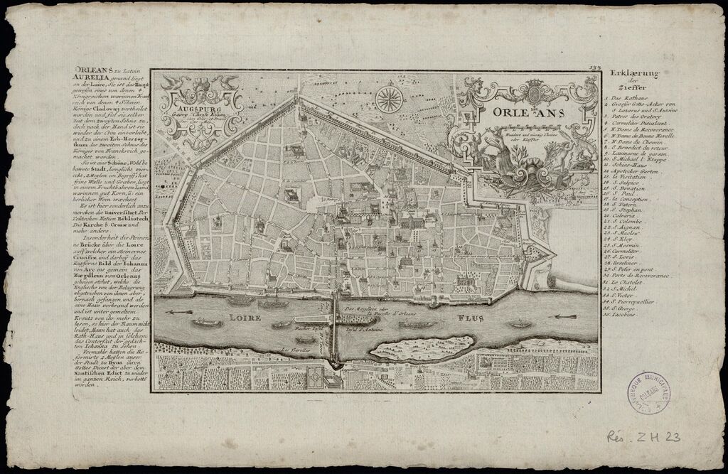
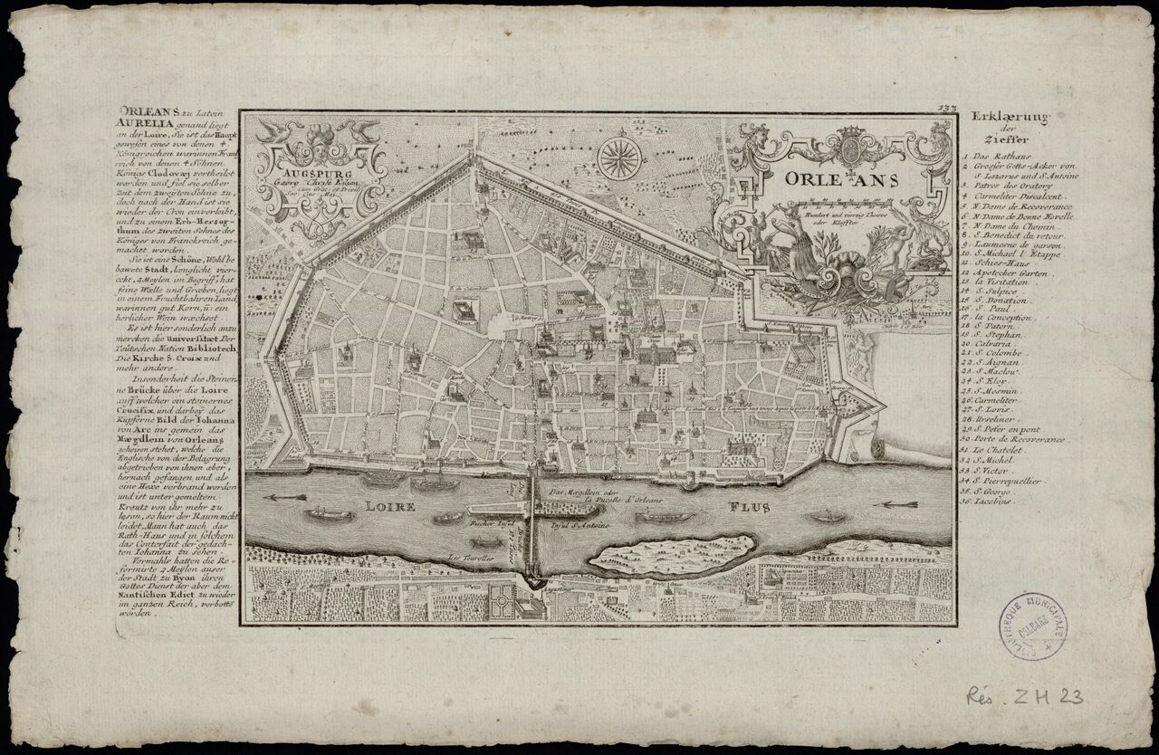
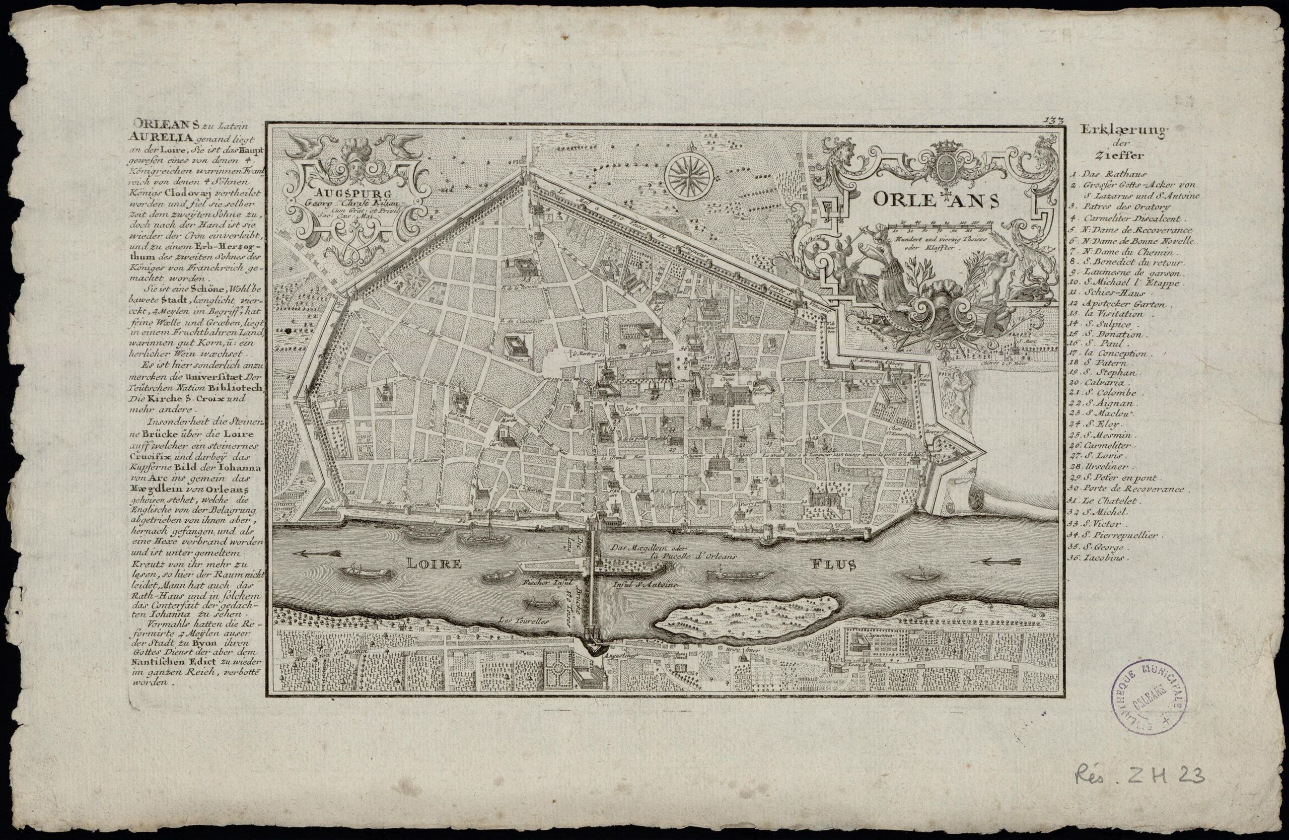
| Description | Orléans. Plan. 1723 |
|---|---|
| Author | Nicola de Fer |
| Source | https://mediatheques.orleans-metropole.fr/ark:/77916/ORL147746/v0001.simple.highlight=Tab.selectedTab=record |
| Date | 1723 |
File history
Click on a date/time to view the file as it appeared at that time.
| Date/Time | Thumbnail | Dimensions | User | Comment | |
|---|---|---|---|---|---|
| current | 07:15, 24 May 2023 | | 3,456 × 2,252 (1.41 MB) | Eric Bie (talk | contribs) | {{Information | description=Orléans. Plan. 1723 | source=https://mediatheques.orleans-metropole.fr/ark:/77916/ORL147746/v0001.simple.highlight=Tab.selectedTab=record | date=1723 | author=Nicola de Fer | other_versions= }} |
You cannot overwrite this file.
File usage
The following page uses this file: