File:Pangasinan Typhoon Pepeng imagery extent (DigitalGlobe Quickbird).png
Jump to navigation
Jump to search

No higher resolution available.
Pangasinan_Typhoon_Pepeng_imagery_extent_(DigitalGlobe_Quickbird).png (520 × 518 pixels, file size: 136 KB, MIME type: image/png)
Information
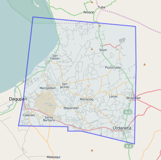
| Description | The blue line shows the extent of the Quickbird satellite imagery donated by DigitalGlobe. The imagery is in Pangasinan in the aftermath of Typhoon Pepeng which caused widespread flooding in the province. The image also shows the roads traced by OpenStreetMappers from all over the world. (See Maning's announcement and the Humanitarian OSM Team page.) |
|---|---|
| Author | seav |
| Source | http://www.openstreetmap.org/?way=48485859 |
| Date | 2010-10-10 |
| Permission | CC-BY 2.0 |
| Other versions | JPEG version taken on 2010-01-18 |
File history
Click on a date/time to view the file as it appeared at that time.
| Date/Time | Thumbnail | Dimensions | User | Comment | |
|---|---|---|---|---|---|
| current | 07:38, 10 October 2010 | | 520 × 518 (136 KB) | Seav (talk | contribs) | ==Information== {{Information |Description = The blue line shows the extent of the Quickbird satellite imagery donated by DigitalGlobe. The imagery is in Pangasinan in the aftermath of Typhoon Pepeng which caused widespread floodin |
You cannot overwrite this file.
File usage
The following 2 pages use this file:
.png&oldid=543694)