File:Plot choropleth cartopy num.png
Jump to navigation
Jump to search


Size of this preview: 325 × 598 pixels. Other resolutions: 130 × 240 pixels | 260 × 480 pixels | 417 × 768 pixels | 1,252 × 2,305 pixels.
Original file (1,252 × 2,305 pixels, file size: 543 KB, MIME type: image/png)
Summary
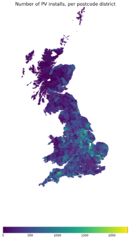
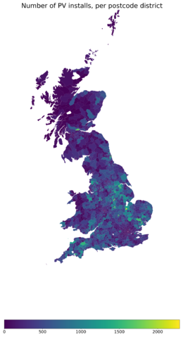
Dan Stowell's choropleth of UK Ofgem FiT data showing num solar PV installations per postcode district, in 2018. Original data was OGL.
Licensing
![]()
I, the creator of this work, hereby release it into the public domain. This applies worldwide.
In case this is not legally possible, I grant anyone the right to use this work for any purpose, without any conditions, unless such conditions are required by law.
Notice to creator or uploader: Please consider using {{CC0-self}} instead for your work.
"Releasing work to public domain" has some issues, as it is not well defined in some jurisdictions and/or it is not actually possible to "release to public domain". Using CC0 license achieves the intended effect while avoiding such problems and is well suited for media files.
File history
Click on a date/time to view the file as it appeared at that time.
| Date/Time | Thumbnail | Dimensions | User | Comment | |
|---|---|---|---|---|---|
| current | 15:24, 27 March 2019 | | 1,252 × 2,305 (543 KB) | Danstowell (talk | contribs) | Dan Stowell's choropleth of UK Ofgem FiT data showing num solar PV installations per postcode district, in 2018. Original data was OGL. |
You cannot overwrite this file.
File usage
There are no pages that use this file.