File:Pra de Cray.jpg
Jump to navigation
Jump to search


Size of this preview: 800 × 600 pixels. Other resolutions: 320 × 240 pixels | 640 × 480 pixels | 1,024 × 768 pixels | 1,280 × 960 pixels | 2,560 × 1,920 pixels | 4,000 × 3,000 pixels.
Original file (4,000 × 3,000 pixels, file size: 8.1 MB, MIME type: image/jpeg)
This file and its description are from Wikimedia Commons.
Summary
| Description |
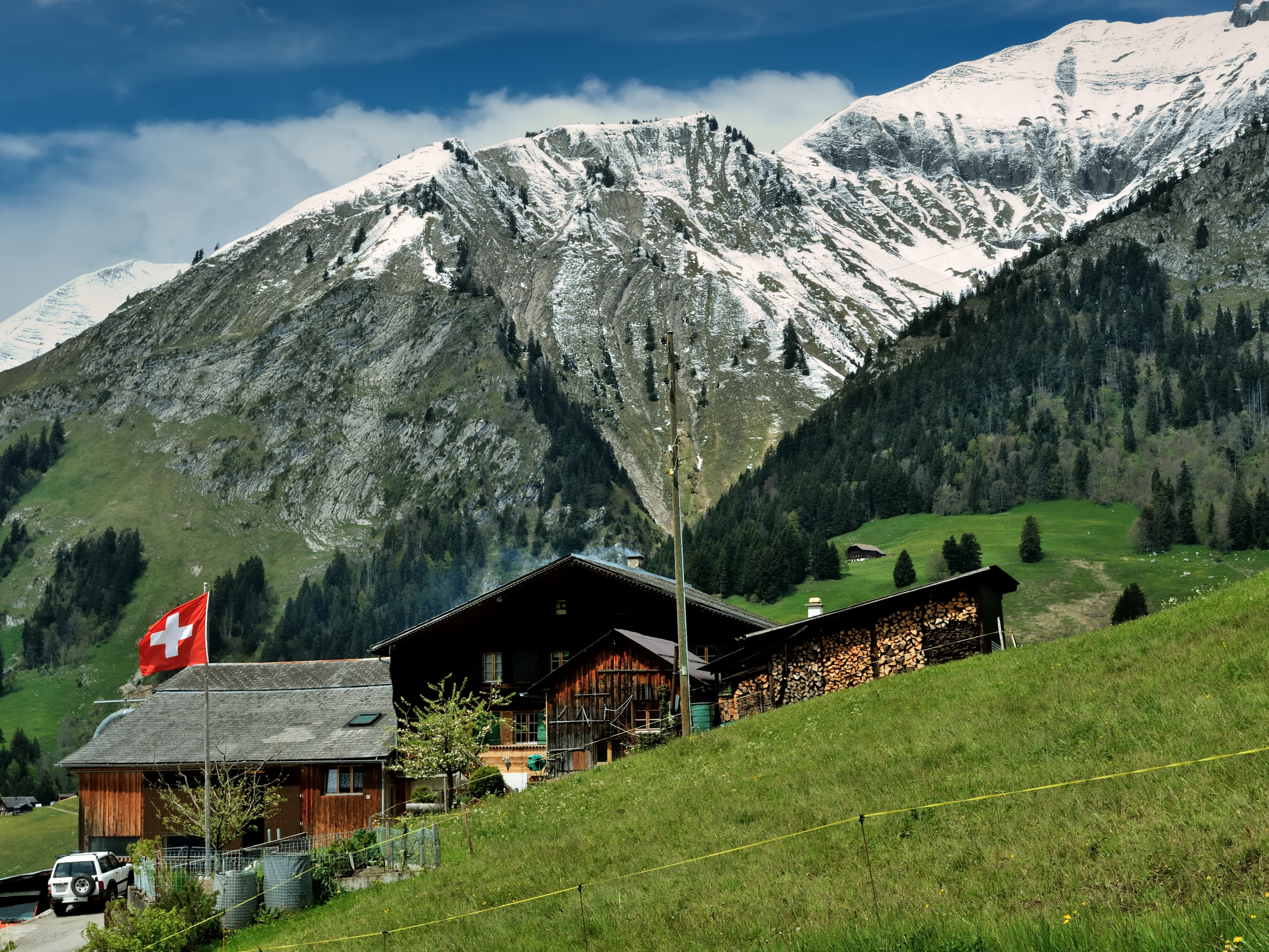
English: View from Le Mont d'Enhaut (foreground) in the commune of Château-d'Oex towards the Pra de Cray (snow-covered peak on the right) and the nationally important dry grassland Le Guenéflin on the slopes of P. 1923 and the peak of the same name, on the left edge of the picture the Pointe de Cray appears in the background, Canton Vaud, Switzerland. Deutsch: Blick von Le Mont d'Enhaut (Vordergrund) in der Gemeinde Château-d'Oex auf den Pra de Cray (schneebedeckter Gipfel rechts) und die national bedeutende Trockenwiese Le Guenéflin an den Hängen des P. 1923 und des Gipfels gleichen Namens, am linken Bildrand erscheint im Hintergrund die Pointe de Cray, Kanton Waadt, Schweiz. Français : Vue depuis Le Mont d'Enhaut (premier plan) dans la commune de Château-d'Oex sur le Pra de Cray (sommet enneigé à droite) et la prairie sèche d'importance nationale Le Guenéflin sur les pentes du P. 1923 et du sommet du même nom, à gauche de l'image apparaît en arrière-plan la Pointe de Cray, canton de Vaud, Suisse. |
||
| Protected | Dry Grassland of National Importance, can be localized on Swisstopo Le Guenéflin.
|
||
| Date | |||
| Source | Own work | ||
| Author | Zacharie Grossen |
| Camera location | | View this and other nearby images on: OpenStreetMap |
|---|
Licensing
I, the copyright holder of this work, hereby publish it under the following license:
This file is licensed under the Creative Commons Attribution-Share Alike 3.0 Unported license.
- You are free:
- to share – to copy, distribute and transmit the work
- to remix – to adapt the work
- Under the following conditions:
- attribution – You must give appropriate credit, provide a link to the license, and indicate if changes were made. You may do so in any reasonable manner, but not in any way that suggests the licensor endorses you or your use.
- share alike – If you remix, transform, or build upon the material, you must distribute your contributions under the same or compatible license as the original.
| Annotations | This image is annotated: View the annotations at Commons |
File history
Click on a date/time to view the file as it appeared at that time.
| Date/Time | Thumbnail | Dimensions | User | Comment | |
|---|---|---|---|---|---|
| current | 12:39, 23 May 2014 | | 4,000 × 3,000 (8.1 MB) | wikimediacommons>Zacharie Grossen | User created page with UploadWizard |
File usage
The following page uses this file: